Catalog Archive
Auction 162, Lot 258

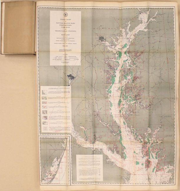
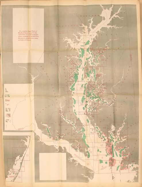
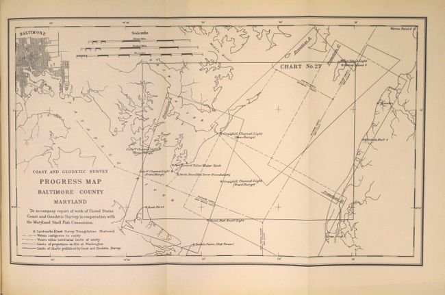
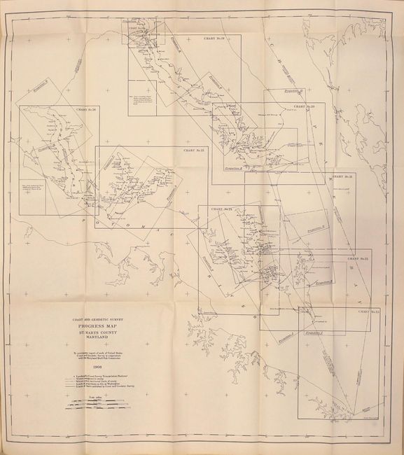
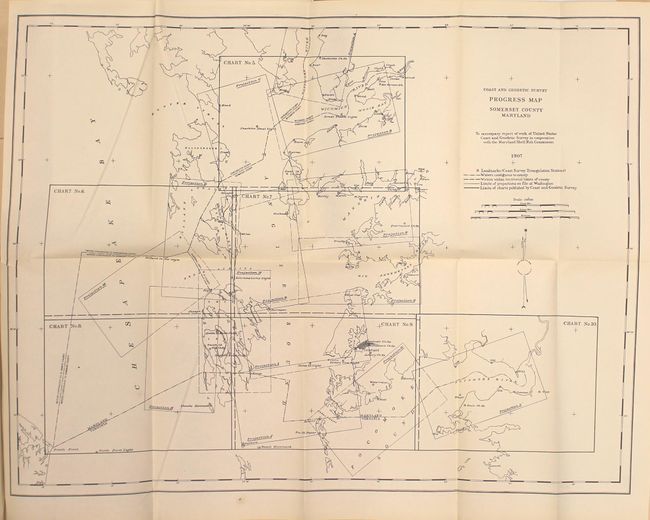
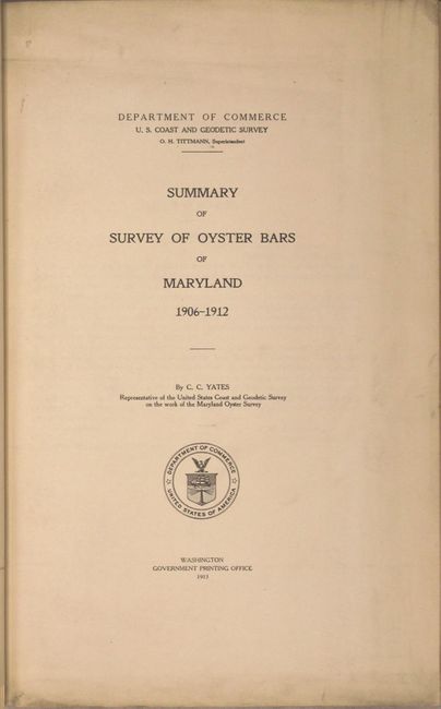
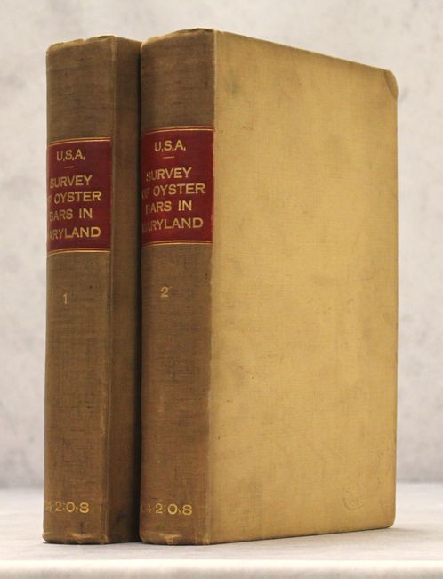
"[2 Volumes] Summary of Survey of Oyster Bars of Maryland 1906-1912...", U.S. Coast & Geodetic Survey

Subject: Maryland

Period: 1912-13 (published)

Publication:

Color: Printed Color

Size:
8 x 12 inches
20.3 x 30.5 cm
Download High Resolution Image
(or just click on image to launch the Zoom viewer)

This two volume set is an important work that was precipitated by the rapidly declining productivity of the oyster grounds in Maryland caused by commercial overfishing and the "oyster wars" fought in the Chesapeake Bay during the late 19th and early 20th centuries. It contains a summary report plus 12 individual county reports dated 1907 to 1913. Of particular interest are two very large charts at the front of volume one, including Index Chart of Natural Oyster Bars Crab Bottoms Clam Beds and Triangulation Stations of Maryland (31 x 40.5") that contains a color-coded key to show oyster beds, crab bottoms, and clam beds in the Chesapeake Bay along with an inset of the Atlantic Ocean from Chincoteague to Ocean City. The 81 page summary report also contains a single-page diagram showing the history of oyster production in the state.

Following the summary report are individual county reports, each containing a map from the Coast & Geodetic Survey. Volume 1 includes: Anne Arundel (1907), 106 pages and folding map (11.2 x 28.5"); Baltimore County (1911), 42 pages and folding map (15.6 x 9.3"); Calvert County (1910), 94 pages and folding map (16.7 x 24.2"); Charles County (1911), 62 pages and folding map (19.5 x 19.2"); Dorchester County (1912), 180 pages and folding map (20.7 x 31.2"); and Kent County (1912), 130 pages and folding map (15.8 x 20.5"). Volume 2 contains: Queen Annes County (1912), 176 pages and folding map (16.7 x 20.4"); St. Mary's County (1911), 203 pages and folding map (27.5 x 31.0"); Somerset County (1908), 118 pages and folding map (27.0 x 20.4"); Talbot County (1912), 250 pages and folding map (19.5 x 24.2"); Wicomico County (1909), 54 pages and folding map (11.3 x 19.7"); and Worchester County (1909), 67 pages and folding map (15.3 x 25.0").

Large quartos, bound in later matching tan buckram with gilt lettered red spine labels.

References:

Condition: B+

The two large folding maps are very good with light toning, and the smaller maps interspersed within the text are clean, bright, and near fine. Text is lightly toned throughout. The exterior has typical shelfwear along with soiling. Both volumes are ex-library with bookplates and withdrawn stamps.

Estimate: $350 - $425

Sold for: $250

Closed on 4/26/2017

Archived