Catalog Archive
Auction 162, Lot 250

"Plan de la Ville et Port de St. Augustin", Bellin, Jacques Nicolas

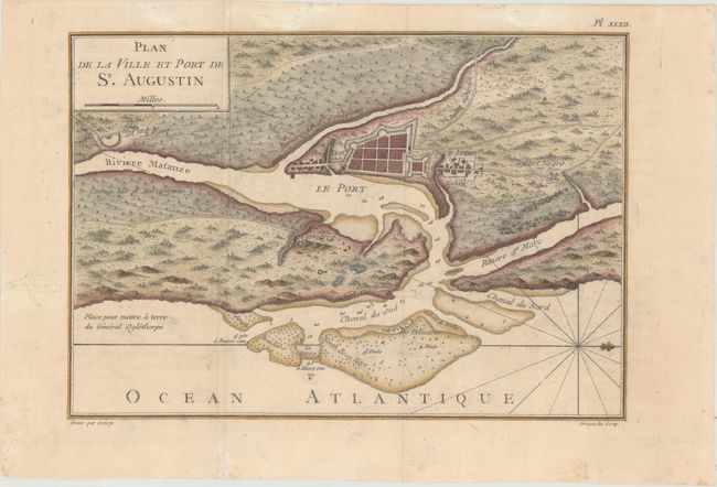
Subject: St. Augustine, Florida

Period: 1768 (published)

Publication: Description Geographique des Debouquemens...

Color: Hand Color

Size:
11.4 x 7.9 inches
29 x 20.1 cm
Download High Resolution Image
(or just click on image to launch the Zoom viewer)

This uncommon copper-engraved map details the fortifications of St. Augustine with good information on the layout of the town and fort and the soundings in the entrance to the harbor. St. Augustine is the oldest European city in the United States. Juan Menendez de Aviles established the first settlement nearly a half century before the first English settlers landed at Jamestown. St. Augustine grew to become the Spanish center of power in North America for almost 200 years. The British gained control of the city in 1763 at about the time of this map's publication. With rhumb lines and a fleur-de-lys orienting north to the right. Drawn by Jean Claude Dezauche and engraved by Croisey.

References:

Condition: B+

Issued folding, now flattened with light printer's ink residue and minor soiling. There is one worm track near the middle of the image, with minor loss of image, and several additional tracks in the blank margins that have all been professionally repaired.

Estimate: $350 - $425

Sold for: $350

Closed on 4/26/2017

Archived