Catalog Archive
Auction 162, Lot 213

"Missouri Territory. Formerly Louisiana", Carey, Mathew
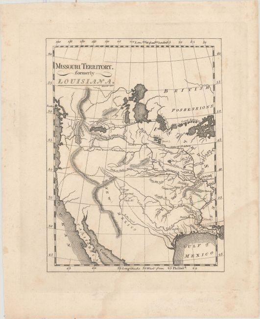
Subject: Western United States

Period: 1814 (published)

Publication: American Pocket Atlas

Color: Black & White

Size:
5.8 x 7.5 inches
14.7 x 19.1 cm
Download High Resolution Image
(or just click on image to launch the Zoom viewer)

Mathew Carey was a seminal figure in early American publishing; establishing the first publishing firm to specialize in cartography and issuing the first atlas devoted exclusively to American maps. He set up an elaborate cottage system of craftsmen for compiling, engraving, printing, and coloring maps. This practice was emulated by later American cartographic publishers such as John Melish and Henry S. Tanner. The American Atlas concept was also adopted by other publishers in both the United States and Europe.

This is one of the earliest printed maps of the Missouri Territory, which was organized in 1812. The map was engraved by John Bower. It provides a fascinating comparison with Carey's larger map of the same title that was published in his General Atlas in 1814, and was also engraved by Bower. While the maps cover the same region, they present entirely different topography, particularly of the mountain ranges and river systems. Only a few place names are given, including New Orleans, St. Charles in present-day Missouri, S. Andero in present-day Texas, and Santa Fe.

References: Phillips (A) #1370-20A.

Condition: B+

A light damp stain at bottom right and a few spots of foxing.

Estimate: $400 - $500

Sold for: $200

Closed on 4/26/2017

Archived