Catalog Archive
Auction 162, Lot 107

NO RESERVE

"Carte qui Represente les Differentes Connoissances que l'on a eues des Terres Arctiques Depuis 1650 Jusqu'en 1747...", Robert de Vaugondy, Didier

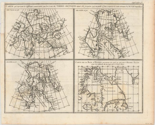
Subject: Eastern Canada

Period: 1773 (dated)

Publication: Diderot's Encyclopedie (Supplement)

Color: Black & White

Size:
15.1 x 12 inches
38.4 x 30.5 cm
Download High Resolution Image
(or just click on image to launch the Zoom viewer)

The Encyclopedie was published under the direction of Diderot from 1751 onward with thousands of articles written by the most prominent philosophers and scientists of the time. These great minds collaborated in the goal of assembling and disseminating the fruits of accumulated knowledge and learning. This massive reference work for the arts and sciences, served to propagate Enlightened ideas. Read a full description of this work and Diderot at Wikipedia.com.

This is the second state of a fascinating group of four maps on one sheet illustrate the cartography of Sanson in 1750, Delisle in 1700 and 1703 and that of the famous Arctic explorer Henry Ellis in his quest for a Northwest Passage via Hudson Bay in 1746-47. All of the maps depict the Hudson and Baffin Bay region, showing the development of the region's cartography between 1650 and 1747.

References: Kershaw #477; Pedley #24.

Condition: B+

Issued folding on watermarked paper with faint offsetting and minor foxing. A binding trim at top left has been replaced with paper.

Estimate: $70 - $90

Sold for: $41

Closed on 4/26/2017

Archived