Catalog Archive
Auction 161, Lot 81

"Carte de l'Amerique, Divisee en ses Principaux Etats", Poirson, Jean Baptiste

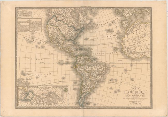
Subject: Western Hemisphere - America

Period: 1833 (dated)

Publication:

Color: Hand Color

Size:
27.2 x 20.3 inches
69.1 x 51.6 cm
Download High Resolution Image
(or just click on image to launch the Zoom viewer)

A handsome map that shows the Western Hemisphere from Cape Horn to the Hudson Bay, and from the Pacific to the western fringes of Europe and Africa. This map includes the information from Cook's discoveries in the Northwest and Alaska in an inset, and the decorative cartouches have been replaced with the simpler lineal flourishes popular at the beginning of the 19th century. The United States is shown with transitional borders with present-day Canada, reflecting the French's preference for U.S. boundary interpretation over the British. Also, Mexico is in control of Texas and the Southwest.

Jean-Baptiste Poirson was a French cartographer active between 1790 and 1830. He was credited on this map as an "engineer-geographer" with revisions by Herisson and published by Jean.

References:

Condition: B+

A nice impression with original color, a few tiny stains in the image, and a centerfold separation confined to the bottom blank margin.

Estimate: $350 - $425

Unsold

Closed on 2/8/2017

Archived