Catalog Archive
Auction 161, Lot 801

"[2 Volumes] Report of the Superintendent of the U.S. Coast and Geodetic Survey Showing the Progress of the Work During the Fiscal Year Ending with June, 1894...", U.S. Coast & Geodetic Survey

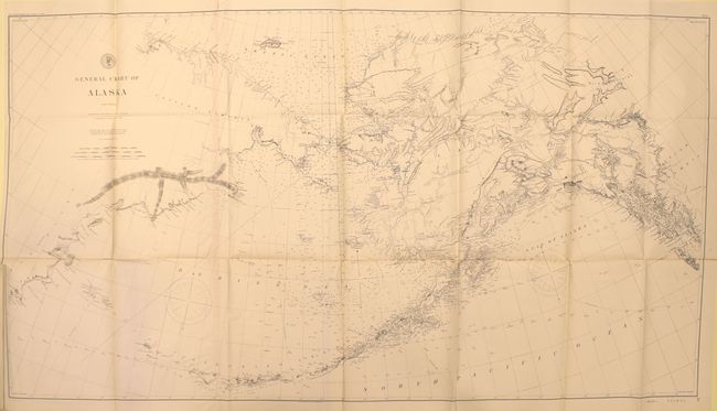
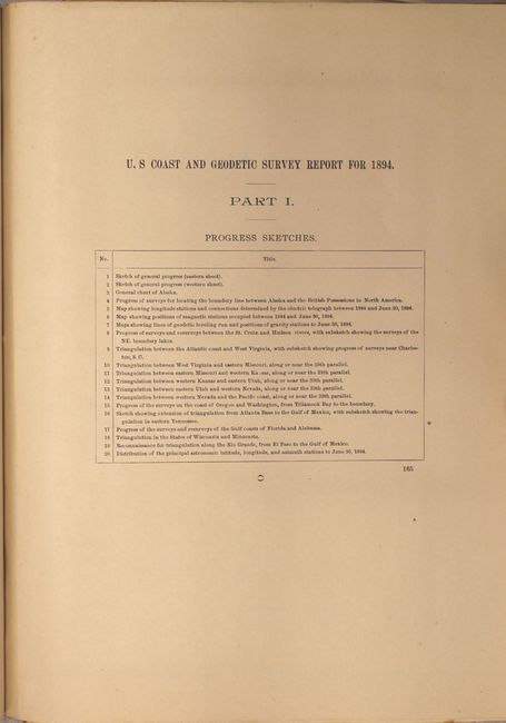
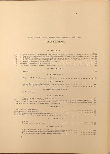
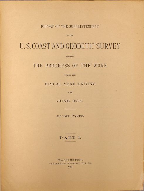
Subject: Exploration & Surveys

Period: 1895 (published)

Publication:

Color: Printed Color

Size:
9.2 x 11.6 inches
23.4 x 29.5 cm
Download High Resolution Image
(or just click on image to launch the Zoom viewer)

These volumes contain a report of field operations for the year. Part I includes the report along with 20 folding "progress" maps; Part II includes the appendices with 6 folding maps, 3 folding graphs, and 4 reproductions of photographs. Folding progress maps include: a detailed General Chart of Alaska (49.75 x 27"), a survey for locating the boundary line between Alaska and Canada, surveys between the St. Croix and Hudson Rivers, and triangulations between the Atlantic coast and West Virginia, in the states of Wisconsin and Minnesota, and many more. See images for the list of maps and illustrations from each volume. Part I - 165 pp.; Part II 625 pp. Quarto, hardbound in original black cloth covered boards with embossed title on spines.

References:

Condition: A

The folding maps and charts are clean and bright with occasional misfolds and short binding tears. The text has very light, even toning. The covers show minor wear.

Estimate: $240 - $300

Sold for: $180

Closed on 2/8/2017

Archived