Catalog Archive
Auction 161, Lot 373

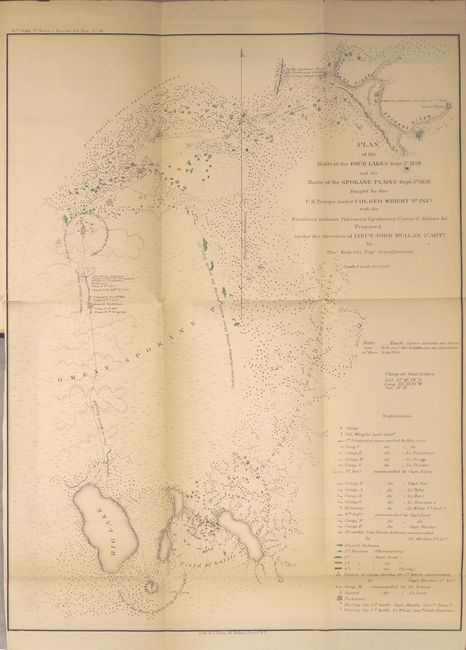
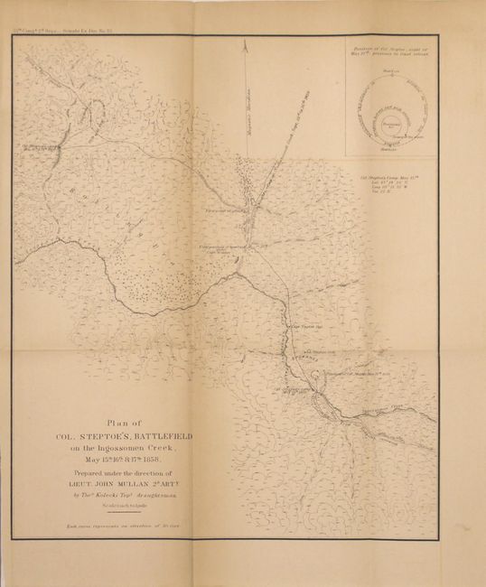
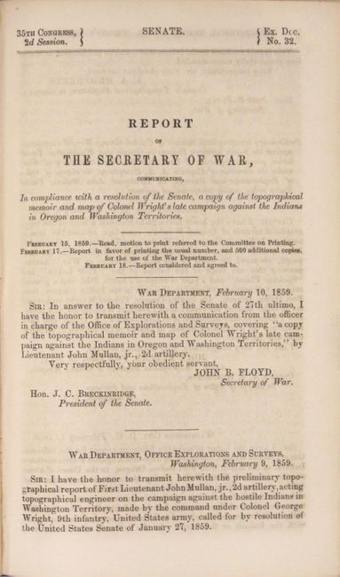
"[Maps in Report] Plan of the Battlefield of the Four Lakes Sept. 1st 1858…[and] Plan of Col. Steptoe's Battlefield on the Ingossomen Creek, May15th, 16th & 17th, 1858", U.S. War Department

Subject: Washington, Spokane Indian Wars

Period: 1859 (published)

Publication: Sen. Ex. Doc. No. 32, 35th Cong, 2nd Sess.

Color: Hand Color

Size:
5.8 x 9.3 inches
14.7 x 23.6 cm
Download High Resolution Image
(or just click on image to launch the Zoom viewer)

Indian wars in Washington Territory were a constant threat during the years following the 1846 division of the Oregon Country from British North America. With the discovery of gold near Colville, Indian hostilities were renewed in the Spokane War of 1858. The first map (12.3 x 16") depicts the decisive defeat of the Indians at Four Lakes and Spokane Plains. The second (9.8 x 11.5", black & white) illustrates the Indian successes against Col. Steptoe's forces. Both maps were prepared under the direction of Lieut. John Mullan of the 2nd Artillery. The maps are still bound into the original 82-page report. Octavo, hardbound in blue cloth over marbled boards.

References:

Condition: B+

The folding maps have light toning, faint offsetting, and a few short splits at fold intersections. The <i>Battle of the Four Lakes</i> map also has a 2" binding tear at left that has been archivally repaired on verso. Text is near fine. Covers have light wear with bumped edges and remnants of an old spine label.

Estimate: $300 - $375

Sold for: $150

Closed on 2/8/2017

Archived