Catalog Archive
Auction 160, Lot 770

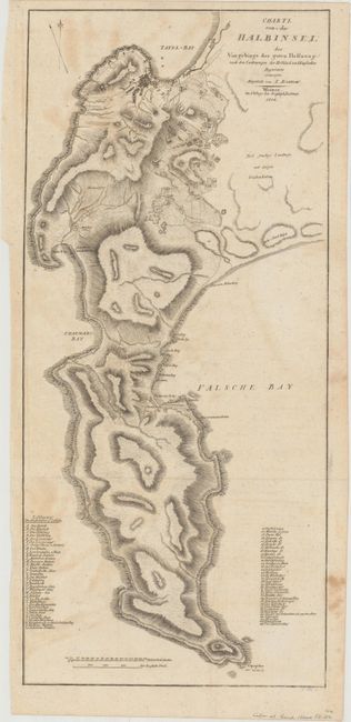
"Charte von der Halbinsel des Vorgebirgs der Guten Hoffnung nach den Zeichnungen der Holland: und Englischen Ingenieurs", Weimar Geographisches Institut

Subject: Southern Africa

Period: 1804 (dated)

Publication: Travels into the Interior of Southern Africa…

Color: Black & White

Size:
9.6 x 21.1 inches
24.4 x 53.6 cm
Download High Resolution Image
(or just click on image to launch the Zoom viewer)

This German edition folding map was published in Sir John Barrow's Travels into the Interior Of Southern Africa.... Barrow served as secretary under Lord Macartney on his trip to settle the government of the newly acquired Cape Colony. The map itself covers the area from Cape of Good Hope north to present-day Cape Town and graphically depicts the rugged topography via hachure. Settlements are noted along the coast with 69 individual buildings drawn and keyed to the map in the vicinity of Table Bay. Engraved by T. Gotz.

References:

Condition: B+

Issued folding with light offsetting in the image and minor staining in the right blank margin.

Estimate: $200 - $250

Sold for: $60

Closed on 11/16/2016

Archived