Catalog Archive
Auction 160, Lot 625
"Pas-Caart van de Weder Zytsche Zee-Kusten soo van Italia als Dalmatia en Griecken Inde Golff van Venetien", Keulen, Johannes van
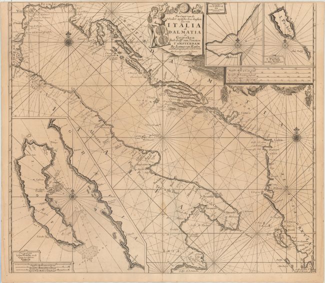
Subject: Adriatic Sea, Corfu
Period: 1710 (circa)
Publication:
Color: Black & White
Size:
23.2 x 20.4 inches
58.9 x 51.8 cm
Download High Resolution Image
(or just click on image to launch the Zoom viewer)
(or just click on image to launch the Zoom viewer)