Catalog Archive
Auction 160, Lot 440

Rare First State of This Important Map of the Brazilian Coast

"Praefecturae Paranambucae pars Meridionalis", Blaeu, Johannes

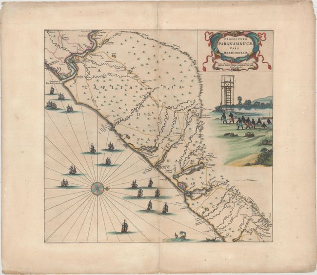
Subject: Eastern Brazil

Period: 1647 (circa)

Publication:

Color: Hand Color

Size:
17.6 x 16.3 inches
44.7 x 41.4 cm
Download High Resolution Image
(or just click on image to launch the Zoom viewer)

This fine map of the Brazilian coast is richly decorated with a scene of natives with a look-out tower and a huge fleet of ships. With north oriented to the right, the map covers the coastal region from Sao Francisco to about Recife. It was drawn after actual surveys by Georg Marcgraf, Elias Herckmanns, and others and was among the first maps of Brazil based on non-Portuguese data. Blaeu first issued this and its companion maps in 1647 for Gaspar Barleus' Rerum per octennium in Brasilia. They were also assembled into a large wall map, Brasilia qua parte paret Belgis. The maps then appeared in the Atlas Maior beginning in 1662. This example has a blank verso and lacks the native in the watchtower that was added by Blaeu for later editions, indicating this is the rare first state of the map.

References: cf. Goss (Blaeu) pp. 184-185; cf. Van der Krogt (Vol. II) #9850/3:2D; Whitehead (TMC-40) pp. 17-20.

Condition: B+

Original color. This example has been trimmed to neatline and mounted on period correct paper with the number 52 printed on the back, indicating that this was likely included in a composite atlas. There is light scattered foxing and light soiling.

Estimate: $1,500 - $1,800

Unsold

Closed on 11/16/2016

Archived