Catalog Archive
Auction 160, Lot 339
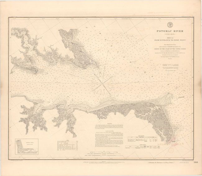
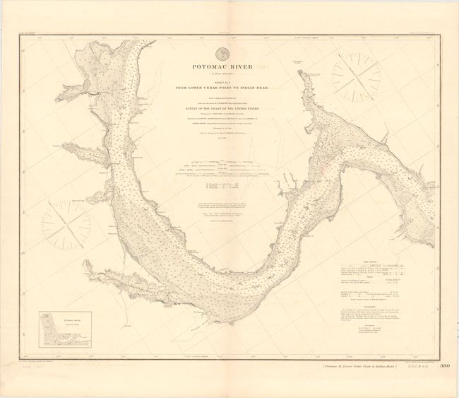
"[Lot of 2] Potomac River (in Four Sheets) Sheet No. I from Entrance to Piney Point... [and] Potomac River (in Four Sheets) Sheet No. 3 from Lower Cedar Point to Indian Head...", U.S. Coast & Geodetic Survey
1 of 2
Subject: Eastern Virginia
Period: 1877-82 (dated)
Publication:
Color: Black & White
Size:
29.6 x 22.9 inches
75.2 x 58.2 cm
Download High Resolution Image
(or just click on image to launch the Zoom viewer)
(or just click on image to launch the Zoom viewer)