Catalog Archive
Auction 160, Lot 302
"Sketch of the Claims to Land on the River St. Marys at Pauwayteeg July 6th 1823", General Land Office
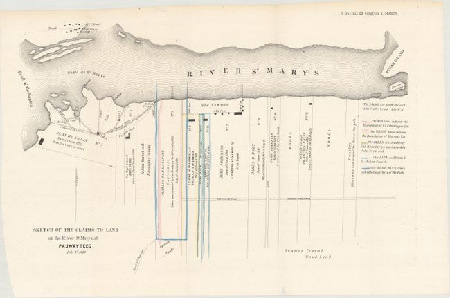
Subject: Sault Ste. Marie, Michigan
Period: 1847 (circa)
Publication: Sen. Doc. 221. 29th Congress 2nd Session
Color: Hand Color
Size:
15.4 x 10.3 inches
39.1 x 26.2 cm
Download High Resolution Image
(or just click on image to launch the Zoom viewer)
(or just click on image to launch the Zoom viewer)