Catalog Archive
Auction 159, Lot 722

"Map of New South Wales Railways Showing Coach and Other Routes from the Various Stations Together with Mileage from Sydney... [in report] New South Wales Handbook...",

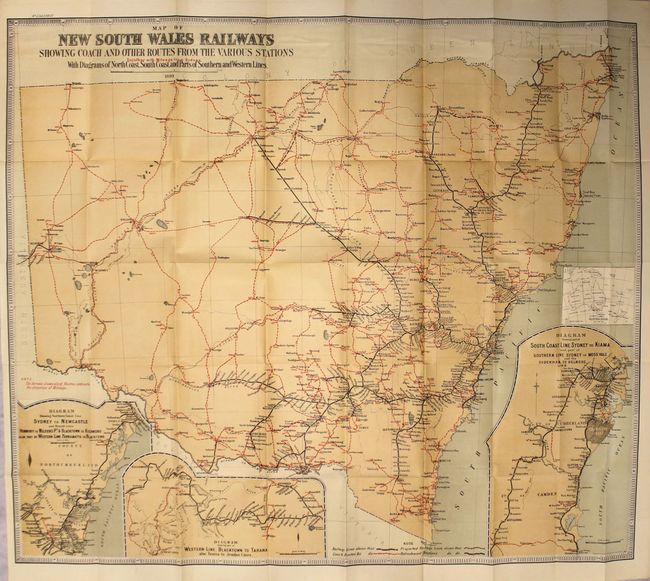
Subject: New South Wales, Australia

Period: 1900 (published)

Publication:

Color: Printed Color

Size:
29.8 x 25.6 inches
75.7 x 65 cm
Download High Resolution Image
(or just click on image to launch the Zoom viewer)

This map shows the evolving transportation network in the state. Railroad lines are identified in black (proposed in dashed lines) while stagecoach routes are shown in red. The map identifies towns/settlements along these paths with marked distances between locations. Insets include routes from Sydney to Newcastle, Blacktown to Tarana, and Sydney to Kiama. Surrounded by a keyboard-style border. The map folds into the 37 page "New South Wales Handbook" issued by the Australian Emigrants' Information Office and contains relevant information on climate, natural resources, agriculture, laws, etc. 8vo.

References:

Condition: B+

A clean, bright example with a few short splits at fold intersections. Report text has light soiling and the paper wrappers are held together with cello tape.

Estimate: $220 - $250

Sold for: $150

Closed on 9/14/2016

Archived