Catalog Archive
Auction 159, Lot 691

"[Lot of 2] Charte von Africa [and] Charte vom Nil Strome oder Aegypten Nubien und Habesch", Geographisches Institut
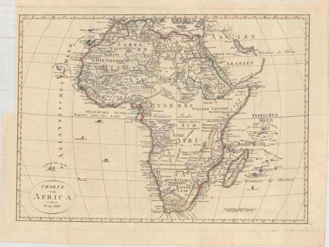
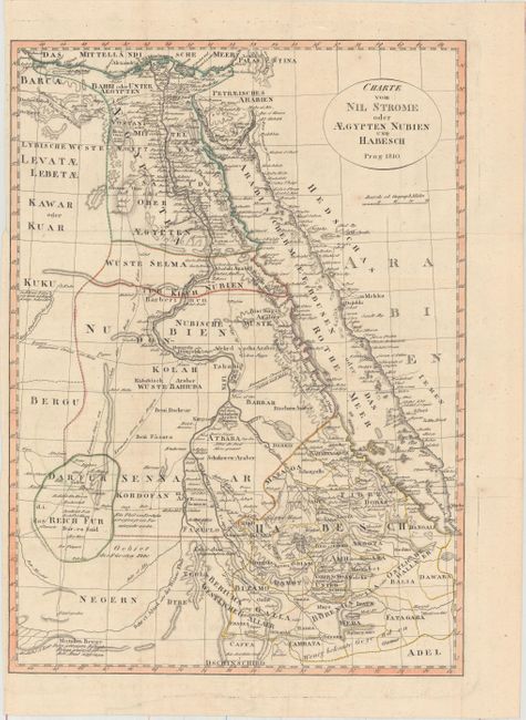
Subject: Africa

Period: 1810 (dated)

Publication:

Color: Hand Color

Size:
See Description
Download High Resolution Image
(or just click on image to launch the Zoom viewer)

This lot of two maps was engraved with typical German precision and includes:

A. Charte von Africa (16.3 x 11.8"). A fine early 19th century map of the continent. The geographical features are concentrated mainly north of the Equator and those regions of the coast that were well known. The unexplored interior is left completely blank except for a few tribal names. The Nile is shown rising from a system of small tributaries in approximately the correct location.

B. Charte vom Nil Strome oder Aegypten Nubien und Habesch (11.8 x 16.4"). This detailed map covers the length of the Nile River flowing into the Mediterranean Sea and extends east to include the Red Sea and the west coast of Arabia. Numerous caravan routes are shown and several notations further describe the geography in some areas.

References:

Condition: B+

Issued folding with light offsetting. The left margin of the second map (Egypt) is narrow, but adequate for framing.

Estimate: $200 - $250

Sold for: $75

Closed on 9/14/2016

Archived