Catalog Archive
Auction 159, Lot 685

"Occidentalior Tractus Indiarum Orientalium a Promontorio Bonae Spei ad C. Comorin", Renard/De Wit

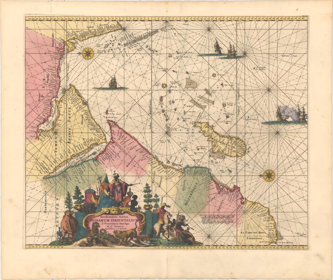
Subject: Indian Ocean

Period: 1715 (circa)

Publication: Atlas de la Navigation et du Commerce

Color: Hand Color

Size:
21.3 x 17.5 inches
54.1 x 44.5 cm
Download High Resolution Image
(or just click on image to launch the Zoom viewer)

This decorative sea chart details the Indian Ocean from the Cape of Good Hope to Kanyakumari (C. Comorin) in India, and includes the Arabian Peninsula, Madagascar, the Maldives, and many smaller islands. Two compass roses orient north to the left, and detail is confined to the coasts with numerous place names. The interior of Africa contains an elaborate title cartouche featuring regional figures and animals, and the map is further embellished by several sailing vessels, with two engaged in battle.

First published circa 1675, de Wit's sea atlas, Orbis Maritimus ofte Zee Atlas, contained 27 charts from the North Pole to North and South America. The charts all appear to have been engraved by Romain de Hooghe and are splendid examples of Dutch marine works. The atlas was reprinted with amendments by Louis Renard in 1715, by Reinier and Josua Ottens in 1739 and 1745, and finally by the widow of van Keulen in 1802.

References: cf. Norwich #256; Shirley (BL Atlases) M.REN-1a; Tibbetts, G.R. #129.

Condition: A

A fine impression in original color with a few minor spots. There is a centerfold separation in the bottom blank margin that has been closed on verso with archival material.

Estimate: $950 - $1,200

Sold for: $700

Closed on 9/14/2016

Archived