Catalog Archive
Auction 159, Lot 511

"Nouvelle Carte de l'Empire du Czar de la Grande-Russie avec les Augmentations & Corrections du Capitaine Iean Perry", Moll, Herman
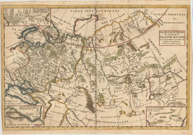
Subject: Russia

Period: 1717 (circa)

Publication: Etat Present de la Grande-Russie

Color: Hand Color

Size:
19.1 x 12.6 inches
48.5 x 32 cm
Download High Resolution Image
(or just click on image to launch the Zoom viewer)

This is a very scarce and unusual chart of the Russian Empire during the reign of Czar Peter the Great. The map provides good detail throughout and features three insets illustrative of the Czar's attempts to modernize Russia by building canals. Captain John Perry, R.N. was employed by the Czar to survey canal routes and design dams between 1698 and 1712. He published The State of Russia Under the Present Czar in 1716. This influential account was widely read and went through numerous editions. This map is from a French edition.

References:

Condition: B+

Issued folding on paper with an "A R" watermark. There is very light toning, a few spots of foxing, a few tiny holes at fold intersections, and a small hole caused by a paper flaw just north of the Caspian Sea. A short fold separation at far let has been archivally repaired. Narrow margins at left and top right, as issued.

Estimate: $300 - $400

Sold for: $200

Closed on 9/14/2016

Archived