Catalog Archive
Auction 159, Lot 422
"A New and Accurate Map of Scotland. Compiled from Surveys, and the Most Approved Maps and Charts. The Whole Being Adjusted by Astronl. Observation", Bowen, Emanuel
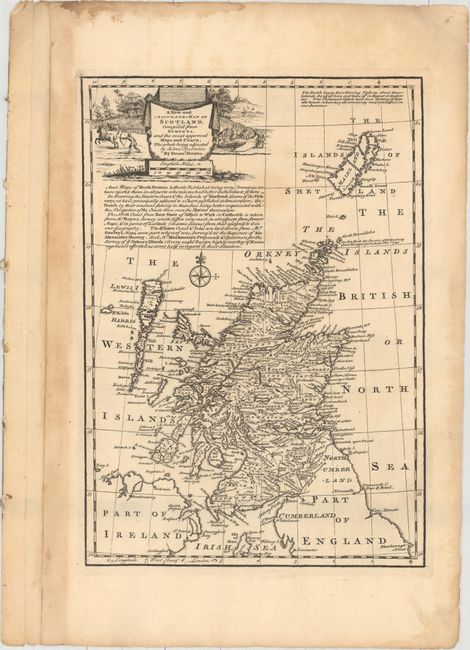
Subject: Scotland
Period: 1747 (circa)
Publication: A Complete System of Geography
Color: Black & White
Size:
8.8 x 12.5 inches
22.4 x 31.8 cm
Download High Resolution Image
(or just click on image to launch the Zoom viewer)
(or just click on image to launch the Zoom viewer)