Catalog Archive
Auction 159, Lot 328

"Plano del Puerto de Veracruz en la Costa Ocidental del Seno Mexicano", Orta, Bernardo de, don

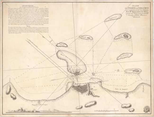
Subject: Veracruz, Mexico

Period: 1798 (dated)

Publication:

Color: Black & White

Size:
22.5 x 17.1 inches
57.2 x 43.4 cm
Download High Resolution Image
(or just click on image to launch the Zoom viewer)

This uncommon chart covers Veracruz and its approaches. It is the first printed hydrographic survey of the region, based on the surveys of (and prepared under the direction of) Bernardo de Orta, the captain of the Royal Armada stationed in Veracruz. The city of Veracruz and its fortifications are depicted in plan form, with a plan San Juan de Ulua, the fortified complex, appearing across the water. Soundings, hazards, various nearby isles, and more navigational information is provided. A view of the rocky, jagged coastline runs across the bottom left corner, and there are extensive navigational notes in the top left corner. The emblem for Deposito Hidrografico is in the bottom right corner. Prepared by Felipe Bauza and engraved by Fernando Selma.

References:

Condition: B

On a sheet with a "SERRA" watermark. There are light damp stains along the right border, light soiling, and an extraneous horizontal crease through the center of the map.

Estimate: $750 - $900

Sold for: $375

Closed on 9/14/2016

Archived