Catalog Archive
Auction 159, Lot 311

"Confederazione Messicana Tratta dalle Ultime Mappe di Humboldt e di Buchon", Le Sage

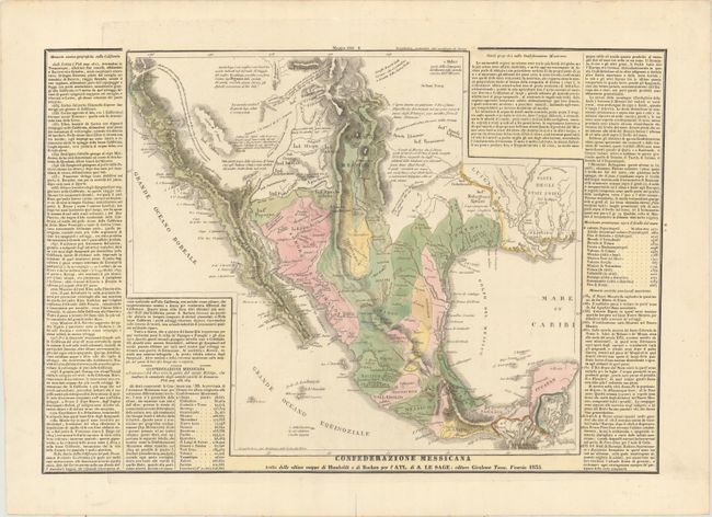
Subject: Southern United States & Mexico

Period: 1835 (dated)

Publication:

Color: Hand Color

Size:
19 x 13 inches
48.3 x 33 cm
Download High Resolution Image
(or just click on image to launch the Zoom viewer)

This uncommon map shows the settled areas of Mexico just one year prior to Texas claiming independence. Le Sage based the map on the work of Alexander von Humboldt and Jean Alexandre Buchon. Texas forms part of San Luis Potosi and New Mexico extends far into the Rocky Mountains. A number of Native Indian tribes are named, and several notes give additional information on the region. The text panels at the sides of the map give a brief history and description of Mexico and California. Published by Girolamo Tasso.

References:

Condition: A

Full original color on watermarked paper with a short centerfold separation in bottom blank margin that has been closed on verso with archival tape.

Estimate: $475 - $600

Unsold

Closed on 9/14/2016

Archived