Catalog Archive
Auction 159, Lot 306

"Mexico and Guatimala", Teesdale, Henry

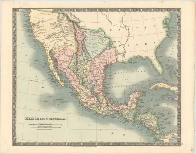
Subject: United States, Mexico & Central America

Period: 1831 (dated)

Publication: A New General Atlas of the World

Color: Hand Color

Size:
16.2 x 13.3 inches
41.1 x 33.8 cm
Download High Resolution Image
(or just click on image to launch the Zoom viewer)

This detailed map of Mexico and Central America extends to include present-day California and Texas. The region north of Texas is simply labeled Desert. New Mexico extends north into the Rocky Mountains. The rivers Timpanogas and San Buenaventura run straight into the Pacific. Locates many Indian tribes, forts and early settlements. Surrounded by a keyboard-style border.

Henry Teesdale was a prominent London publisher and founding fellow of the Royal Geographical Society. He produced large-scale maps and charts and a number of fine atlases in the early part of the nineteenth century. He employed the most skilled draftsmen and engravers and his maps are renowned for precise detail and fine coloring. His maps are increasingly scarce on the market.

References:

Condition: A+

A clean and bright example with lovely original color on paper watermarked "J. Whatman 1831."

Estimate: $200 - $230

Sold for: $180

Closed on 9/14/2016

Archived