Catalog Archive
Auction 159, Lot 221

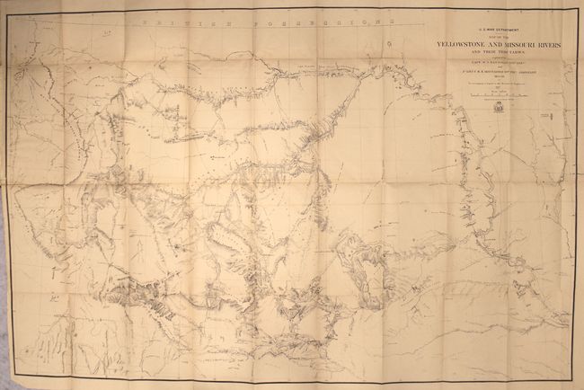
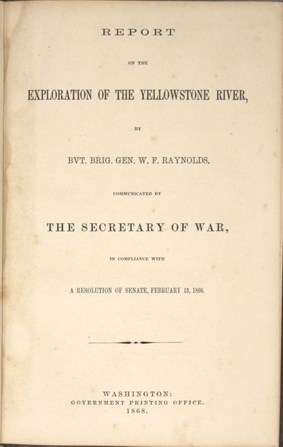
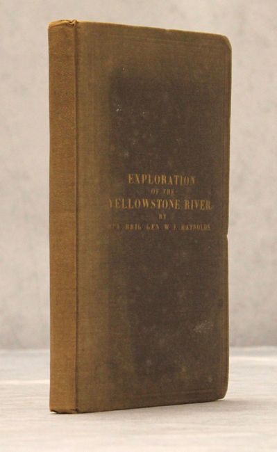
"Map of the Yellowstone and Missouri Rivers and Their Tributaries... [with] Report on the Exploration of the Yellowstone River…", U.S. War Department

Subject: Western United States

Period: 1868 (published)

Publication: Sen. Ex. Doc. 77, 40th Congress, 1st Session

Color: Black & White

Size:
41.8 x 26.9 inches
106.2 x 68.3 cm
Download High Resolution Image
(or just click on image to launch the Zoom viewer)

A large and very detailed map of the region explored by Capt. W.F. Raynolds in 1859-60. His report was delayed until 1866 due to the outbreak of the Civil War which sent him and his assistants off to war. While he was away, he came down with a "severe and protracted illness" which caused further delays. It was eventually completed when mining developments and conflicts with Indian tribes in the region made it important. The map includes post 1860 developments such as Ft. Casper and Camp Marshall on the upper North Platte, as well as the Tetons, Jackson's Hole, and several new forts and emigrant roads. Included with the map is the 174 pp. "Report on the Exploration of the Yellowstone River...Communicated by the Secretary of War, in Compliance with a Resolution of Senate, February 13, 1866." Octavo, hardbound in brown cloth with gilt title on front cover.

References: Phillips (Maps) p. 1130.

Condition: B+

Light toning, faint offsetting, and a few tiny splits at fold intersections. A binding tear at left that extends 2" into the image has been closed on verso with archival tape. Report text is mostly clean and bright. Covers are sunned near the spine and the edges are bumped.

Estimate: $500 - $650

Sold for: $300

Closed on 9/14/2016

Archived