Catalog Archive
Auction 159, Lot 212

"[Lot of 3] Map Showing the Lands Assigned to Emigrant Indians West of Arkansas & Missouri [and] [Untitled - Western Territory] [and] [Report] ", U.S. Government

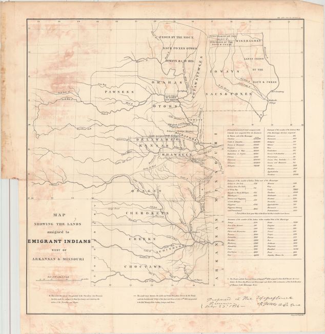
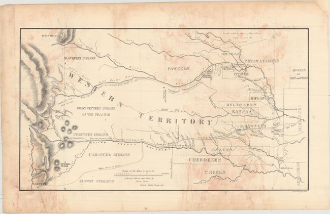
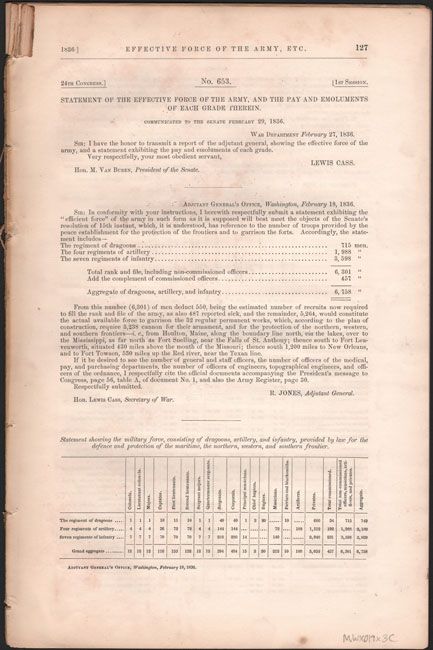
Subject: Central United States

Period: 1860 (published)

Publication: American State Papers, Vol. 1

Color: Black & White

Size:
See Description
Download High Resolution Image
(or just click on image to launch the Zoom viewer)

A. Map Showing the Lands Assigned to Emigrant Indians West of Arkansas & Missouri (17.8 x 18.7"). This attractive map covers the region of present day Iowa, Nebraska, Kansas and Oklahoma. The tribal lands are outlined in fine, original hand color. An inset provides tabulations of the numbers of Indians and a listing of estimated acres of land assigned to these Tribes. While it shows the Santa Fe Road, the route of Col. Dodge is not depicted. The map is based on the 1835 map prepared by Lt. Washington Hood and Wheat calls it "an important historical map." It documents an ugly phase of American history during the first half of the 19th century when Indian tribes were forced to migrate to the areas shown.

B. [Untitled - Western Territory] (17.8 x 10.0"). This map, attributed to Lt. Steen, details the 1835 expedition of Dragoons under the command of Colonel Henry P. Dodge. It extends from Pike's Peak, Touse (Taos) and Santa Fe in the west and east to Fort Leavenworth. It locates rivers, mountains, Indian reservations, Indian villages, military posts, and the Santa Fe Trail. A landmark map for illustrating land holdings of the Western Indians.

Included with the maps is the 20-page report from the American State Papers.

References: cf. Wheat (TMW) #418 & #421; cf. Claussen & Friis #127 & #128; cf. Wagner-Camp #63.

Condition: B

Issued folding with light to moderate staining. Report text is very good with light staining.

Estimate: $180 - $220

Sold for: $90

Closed on 9/14/2016

Archived