Catalog Archive
Auction 159, Lot 188

Rare Pocket Map Edition

"Map of Virginia and Maryland Constructed from the Latest Authorities", Finley, Anthony

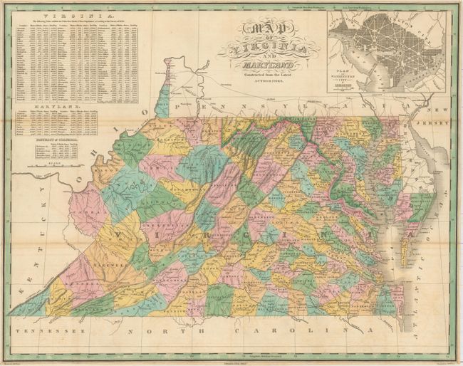
Subject: Mid-Atlantic United States

Period: 1829 (circa)

Publication: A New American Atlas...

Color: Hand Color

Size:
21.7 x 17.2 inches
55.1 x 43.7 cm
Download High Resolution Image
(or just click on image to launch the Zoom viewer)

This detailed map depicts counties, county seats, roads, and rivers through Virginia and Maryland. At top left are tables showing the 1820 census of white, free black, and slave populations by county in Virginia, Maryland, and the District of Columbia. At top right is a bird's-eye plan of DC and Georgetown. This map is from a pocket edition of Finley's A New American Atlas, which was first issued in 1826 with dates printed in the lower margin. This undated edition was likely from an 1829 edition, which contained 15 maps, most of which were not dated. Drawn by D.H. Vance and engraved by J.H. Young.

References:

Condition: B+

Issued folding, now pressed, and professionally backed in Japanese tissue to repair some short fold separations with a few minute losses. Original color with light toning along a few folds. Trimmed close to neatlines.

Estimate: $950 - $1,200

Sold for: $500

Closed on 9/14/2016

Archived