Catalog Archive
Auction 159, Lot 178

"Nova Virginiae Tabula", Montanus/Ogilby

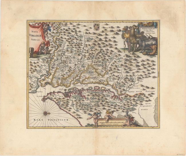
Subject: Colonial Mid-Atlantic United States

Period: 1671 (circa)

Publication: America...

Color: Hand Color

Size:
14.1 x 11.5 inches
35.8 x 29.2 cm
Download High Resolution Image
(or just click on image to launch the Zoom viewer)

Montanus' work was perhaps the greatest illustrated book on the New World produced in the seventeenth century. It contained over one hundred beautifully engraved plates, views, and maps of North and South America. The plates vividly depict forts, festivals, occupations, Dutch fleets, battles, religious rites, and customs of the native inhabitants. This important work was translated into German by Olivier Dapper, and into English by John Ogilby. Several of the plates were later acquired by Pierre Vander Aa.

This is a very decorative, carefully made map based on the Hondius/Blaeu version of John Smith's prototype of Virginia and the Chesapeake Bay. It is beautifully engraved with mountains, rivers, and forests and provides a wealth of information concerning the Indian villages in the region. The title and distance scale cartouches feature putti and a scene at upper right features Native Americans with a llama, unicorn, and a fat-tailed sheep. This is state two, issued by Ogilby.

References: Burden #412; Tooley (Amer) p.168-9, plt. 76; Goss (NA) #38.

Condition: A

Excellent impression and color with light soiling in the wide margins.

Estimate: $1,100 - $1,300

Sold for: $600

Closed on 9/14/2016

Archived