Catalog Archive
Auction 159, Lot 14

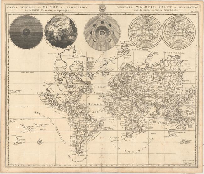
"Carte Generale du Monde, ou Description du Monde Terrestre & Aquatique / Generale Waereld Kaart, of Beschryving van de Land en Water Waereld", Mortier, Pierre

Subject: World

Period: 1700 (circa)

Publication:

Color: Black & White

Size:
18.6 x 15.8 inches
47.2 x 40.1 cm
Download High Resolution Image
(or just click on image to launch the Zoom viewer)

This is Pierre Mortier's unique world map drawn on Mercator's projection. It depicts California as an island and the Detroit d'Anian connected by dotted lines through a Northwest Passage to Button's Bay located to the west of Hudson Bay. There is an erroneous large lake shown as the source for the Rio Norte (Rio Grande River) located in the Southwest, as well as an early, open-ended version of the Great Lakes named Mer Douce. A small coastline of New Zealand appears in the Pacific. The northeast coast of Asia is severely truncated and shows Witsen's Cap de Glaces. Australia's northern coast is shown connected to New Guinea, and two disjointed coastlines appear to the south, including Van Diemen's Land. The most interesting features of the map are the five spheres presented along the top depicting day and night, the flood, the phases of the moon, and the Western and Eastern Hemispheres. The map was precisely engraved by Jan van Luchenburg (imprint at lower left). This is the first state with Mortier's imprint at bottom right.

References: Shirley #622.

Condition: B+

On watermarked paper with short fold separations at top and bottom and light scattered foxing primarily along the centerfold. The bottom separation and a few short edge tears have been repaired on verso with old paper.

Estimate: $950 - $1,200

Sold for: $550

Closed on 9/14/2016

Archived