Catalog Archive
Auction 158, Lot 466

NO RESERVE

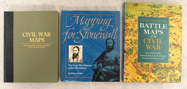
"[Lot of 3] Civil War Maps - An Annotated List of Maps and Atlases in the Library of Congress [and] Mapping for Stonewall - The Civil War Service of Jed Hotchkiss [and] American Heritage - Battle Maps of the Civil War",

Subject: References

Period: 1989-93 (published)

Publication:

Color: Printed Color

Size:
See Description
Download High Resolution Image
(or just click on image to launch the Zoom viewer)

A. Civil War Maps - An Annotated List of Maps and Atlases in the Library of Congress, by Richard W. Stephenson, published 1989 (8.7 x 11.3"). This is a signed copy of the expanded second edition of this reference covering the maps and atlases of the American Civil War. The book includes 2240 maps and charts, 76 atlases and sketch books, 162 maps and 28 collections of paper from the Library of Congress's Manuscript Division, and a few additional atlases that accompany volumes in the Library's general book collections. It focuses not only on maps and atlases made during the war, but also those made in the aftermath. Entries include descriptive notes, and there are plenty of illustrations, some in color. 410 pp, hardbound with gilt titles on front cover and spine and a gilt Library of Congress stamp on the back cover. Condition: Contents are very good with some minor soiling along the bottom edge of the sheets that is not visible when looking through the pages. Binding is a little loose. There is minor wear along the bottom of the covers and spine. (B+)

B. Mapping for Stonewall - The Civil War Service of Jed Hotchkiss, by William J. Miller, published 1993 (9.4 x 11.3"). This is the fascinating chronicle of Jed Hotchkiss, a Virginia schoolteacher who served as a cartographer and topographer for Stonewall Jackson and Robert E. Lee's Army of Northern Virginia. His mapping of the Shenandoah Valley was integral to Jackson's Valley Campaign (1862). The book is filled with Hotchkiss' maps and various photographs and illustrations. Hardbound in gray cloth with an illustrated dust jacket. 176 pp. Condition: Like new but for very minor shelf wear. (A)

C. American Heritage - Battle Maps of the Civil War, by Richard O'Shea, published 1992 (9.8 x 13.0"). This superb reference documents 17 of the major battles of the Civil War through maps and illustrations. The book provides a unique mix of never-before-published historic maps drawn in the aftermath of the battles, David Greenspan's pictorial maps first published in The American Heritage Picture History of the Civil War in 1960, aerial photography of battlefields, battle paintings by Don Troiani, and more. Bull Run, Antietam, Gettysburg, and Chattanooga are among the battles covered. Hardbound in black cloth with gilt title on the spine and an illustrated dust jacket. 176 pp. Condition: Near fine with a hint of shelf wear to the dust jacket. (A)

References:

Condition:

See description above.

Estimate: $50 - $70

Sold for: $41

Closed on 6/22/2016

Archived