Catalog Archive
Auction 158, Lot 422

Rare and Decorative De Jode Map with Superb Impression

"Africae Vera Forma, et Situs", Jode, Cornelis de
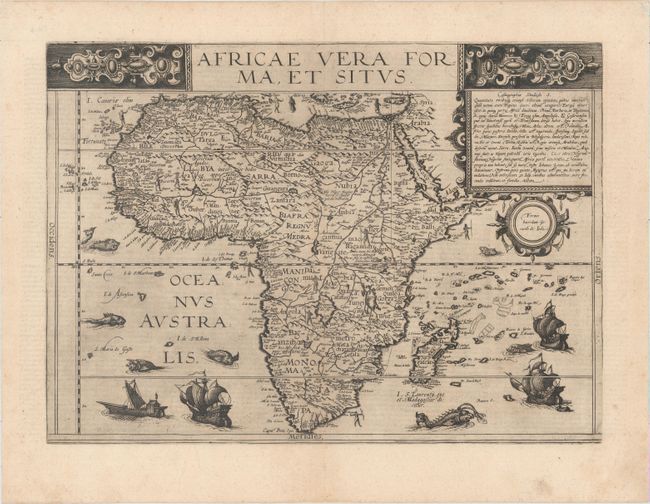
Subject: Africa

Period: 1593 (published)

Publication: Speculum Orbis Terrae

Color: Black & White

Size:
17.8 x 12.9 inches
45.2 x 32.8 cm
Download High Resolution Image
(or just click on image to launch the Zoom viewer)

This exceedingly rare map is an interesting amalgamation of cartographical sources. Cornelis prepared this map for the second edition of the Speculum after his father's death in 1591. It replaced the African map of the first edition that had been attributed to Gastaldi. This map retains the continental outline from Gastaldi with the interior based primarily on Mercator's world map of 1569. This is most evident in the river systems, including Sachaf lac as the source of the Zabere (Zembere), Cuama and R. d S. Spirito rivers in southern Africa. The map also incorporates information from Ortelius including the placement of Zanzibar on the southwest coast. The map is beautifully adorned with ships and sea monsters and representations of the native people scattered across the map. Unfortunately Cornelis' atlas met the same fate as that of his father's atlas, with very few copies being sold. On the death of Cornelis, the copper plates were sold to Jan Baptist Vrients, the publisher of Ortelius' atlas, who acquired them merely to stop their re-issue. As a result the map is very rare. Latin text on verso.

References: Betz #27; Norwich #19.

Condition: A+

A superb, dark impression on watermarked paper with minor marginal soiling.

Estimate: $6,000 - $7,500

Sold for: $6,500

Closed on 6/22/2016

Archived