Catalog Archive
Auction 158, Lot 382

"Novissima Totius Terrae Sanctae sive Promissionis Descriptio", Funcke/Homann
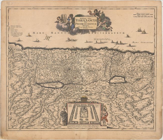
Subject: Holy Land

Period: 1700 (circa)

Publication:

Color: Hand Color

Size:
21.8 x 18.2 inches
55.4 x 46.2 cm
Download High Resolution Image
(or just click on image to launch the Zoom viewer)

This map of the Holy Land is oriented with north to the top right corner and shows Palestine on both sides of the Jordan River extending from Sidon, Lebanon to Egypt. At bottom is a vignette depicting the encampment of the Israelites around the Tabernacle and flanked by Jesus and Moses. The decorative title cartouche is held up by putti, with one holding the Tablets of the Law. The map was engraved by Johann Baptist Homann with his imprint at lower right. David Funcke employed the young Homann as an engraver prior to the establishment of the Homann publishing empire. His maps are rarely offered on the market.

References: Laor #296.

Condition: B+

Light toning and soiling with several tiny edge tears confined to the blank margins closed on verso with tissue.

Estimate: $700 - $900

Unsold

Closed on 6/22/2016

Archived