Catalog Archive
Auction 158, Lot 341

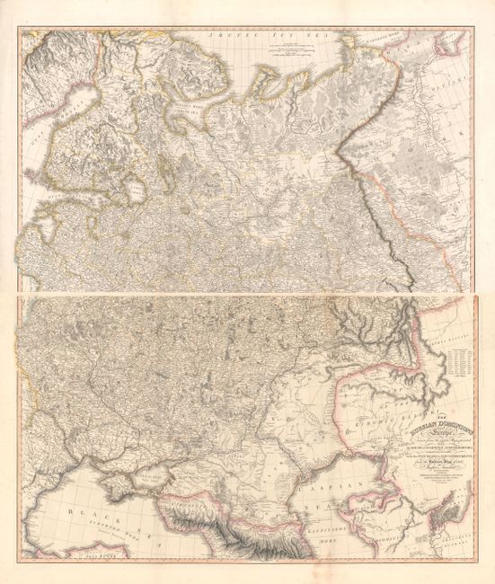
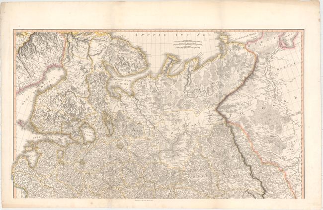
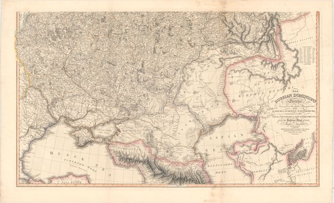
"[On 2 Sheets] The Russian Dominions in Europe Drawn from the Latest Maps, Printed, by the Academy of Sciences, St. Petersburg...", Faden, William

Subject: Eastern Europe, Russia

Period: 1808 (dated)

Publication:

Color: Hand Color

Size:
36.4 x 21.1 inches
92.5 x 53.6 cm
Download High Resolution Image
(or just click on image to launch the Zoom viewer)

Superb, large-scale map printed on two sheets of what was then known as White Russia. The map extends north through the Ukraine to Smolensk and east to the Caspian Sea on the southern map; and includes Finland, the Arctic Sea coast, Muscovia, Archangel, and parts of Siberia on the northern map. Filled with incredible detail including the post roads, ancient ruins and interesting notations. This map was originated by Jasper Nantiat drawn from the maps of the Academy of Sciences at St. Petersburg; this is the rare first state published by William Faden in 1806. Later editions published by James Wyld, successor to Faden, are much more commonly found on the market. Size is for each sheet - if joined the map would measure 36 x 42".

References:

Condition: B+

Original outline color, issued folding with several small areas of light soiling and professional repairs to a few short separations along the folds. Overall very good condition for this size map.

Estimate: $550 - $650

Sold for: $650

Closed on 6/22/2016

Archived