Catalog Archive
Auction 158, Lot 283

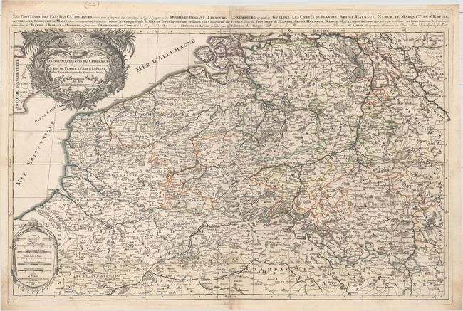
"Les Provinces des Pays-Bas Catholiques Distinguees Suivant qu' elles sont Presentement Partagees Entre le Roy de France, le Roy d'Espagne, et les Estats Generaux des Provinces-Unies", Sanson/Jaillot

Subject: Belgium & Luxembourg

Period: 1696 (dated)

Publication: Atlas Nouveau

Color: Hand Color

Size:
34.5 x 21.3 inches
87.6 x 54.1 cm
Download High Resolution Image
(or just click on image to launch the Zoom viewer)

This splendid, large map of the Low Countries covers present-day Belgium and Luxembourg, extending north to Breda, Netherlands, east to Dusseldorf and Cologne, Germany, and south to Reims, France. The map is filled with details of political boundaries, towns, rivers and forested areas. The map is handsomely adorned with a drape-style distance cartouche and an elaborate title cartouche featuring symbols of wealth and the Sun King emblem with the Latin motto Nec Pluribus Impar (not unequal to many). An additional extended French title appears above the map: "Les Provinces des Pays-Bas Catholiques, Restees pour la plus part sous l'Obeissance du Roy d'Espagne..." Printed on two sheets, joined as issued.

References: Pastoureau, JAILLOT I E [19].

Condition: B+

Original outline color with minor soiling, an archivally repaired centerfold separation that enters less than 1" into map at bottom, and some small worm holes in bottom corners that have been professionally repaired and only one of which passes the neatline. Remnants of hinge tape on verso.

Estimate: $300 - $400

Sold for: $150

Closed on 6/22/2016

Archived