Catalog Archive
Auction 158, Lot 260

"Manica, Gallis la Manche, et Belgis het Canaal, Pars Oceani Inter Angliam et Galliam...", Visscher, Nicolas

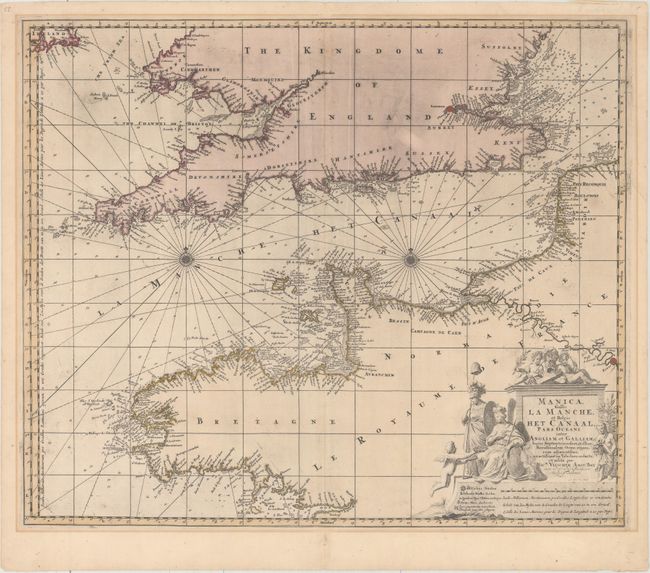
Subject: English Channel

Period: 1657 (circa)

Publication:

Color: Hand Color

Size:
22.3 x 18.8 inches
56.6 x 47.8 cm
Download High Resolution Image
(or just click on image to launch the Zoom viewer)

This large-scale chart centers on the English Channel and details the coastline of southern Britain and northern France. In England & Wales the map extends as far north as Suffolk and Pembrokeshire, and inland to London on the Thames. In France the chart extends south to Brittany, and inland to Paris on the Seine. Just the southern tip of Ireland is included. There is great navigational information with soundings, shoals, and anchorages. The chart includes two compass roses and rhumb lines. The allegorical title cartouche features a royal figure holding the coat of arms of King William III of England and a female figure holding a staff with the liberty cap. Engraved by Gilliam Gouwen.

References:

Condition: B+

Full original color with light printer's ink residue in England, a professionally repaired hole in the Bristol Channel, and two creases adjacent to the centerfold at top. There is mat burn outside of the image, and masking tape along the top edge of the sheet on verso, entirely above the image.

Estimate: $400 - $475

Unsold

Closed on 6/22/2016

Archived