Catalog Archive
Auction 158, Lot 25

"Mappe-Monde pour Connoitre les Progres & les Conquestes les Plus Remarquables des Provinces-Unies...", Chatelain, Henry Abraham
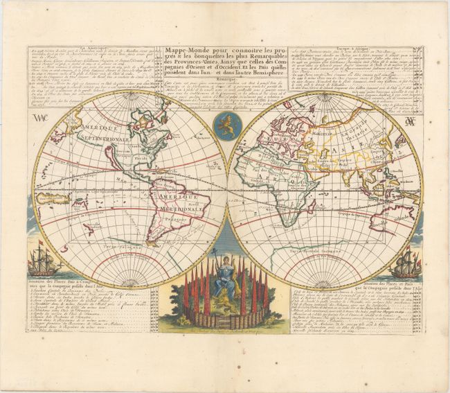
Subject: World

Period: 1719 (circa)

Publication: Atlas Historique…

Color: Hand Color

Size:
17.9 x 13 inches
45.5 x 33 cm
Download High Resolution Image
(or just click on image to launch the Zoom viewer)

The voyages and discoveries of the Dutch East India Company (VOC) and other Dutch trading companies are the subject of this handsome, double-hemisphere map of the world. California is shown as a prominent island, the Great Wall is shown in China, and the incomplete coasts of Australia and New Zealand are shown in the South Pacific. The tables describe the voyages by Dutch explorers and important events in the Dutch colonies - from 1594 (the first attempt to find a Northeast Passage to Asia) to 1665 when New Holande (New York) was captured by the British. The map is beautifully decorated with ships, a medallion and a female figure seated within an elaborate fortification holding a horn of plenty with a staff topped with a liberty cap, and guarded by a lion representing Holland. First published without the decorative elements around 1670; this is the later edition published by Chatelain.

References: Shirley #447.

Condition: A

Attractive color on a bright sheet of watermarked paper with a few tiny spots of foxing, primarily confined to the blank margins.

Estimate: $700 - $850

Sold for: $500

Closed on 6/22/2016

Archived