Catalog Archive
Auction 158, Lot 254
"Regnum Scotiae, seu pars Septent: Magnae Britanniae, Divisa in Scotiam Septent: et Australem, Porro Autem in Comit: Rossiam Moraviam, Argatheliam et Gallo Vidiam...", Valck, Gerard and Leonard
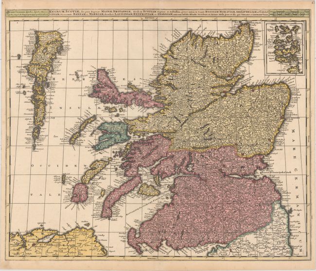
Subject: Scotland
Period: 1705 (circa)
Publication:
Color: Hand Color
Size:
23.2 x 19.2 inches
58.9 x 48.8 cm
Download High Resolution Image
(or just click on image to launch the Zoom viewer)
(or just click on image to launch the Zoom viewer)