Catalog Archive
Auction 158, Lot 24

"Planisfere ou Mapemonde avec les Degrez de Latitude & de Longitude",
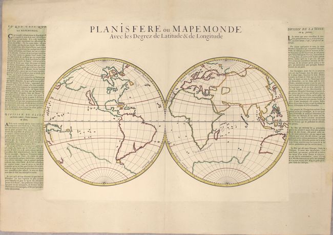
Subject: World

Period: 1697 (circa)

Publication:

Color: Hand Color

Size:
29.1 x 14.6 inches
73.9 x 37.1 cm
Download High Resolution Image
(or just click on image to launch the Zoom viewer)

This simple double-hemisphere map of the world is presented only with the outlines of the continents and islands. Almost all nomenclature has been omitted, with the exception of Paris, the Cape of Good Hope, and the Canary Islands. The map depicts California as an island and has only a partial outline of Australia and New Guinea. Several conjectural lands still appear, including a large southern continent and a partially delineated land to the east of Japan, stretching across the North Pacific. The degrees of latitude and longitude are marked on the spheres. Created by Louis Dangeau, this map was published in his geography book, Nouvelle Methode De Geographe Historique... with a column of explanatory text to the right of the map. Interestingly, this example has been pasted on to another sheet of larger paper with columns of French text pasted at either side of the map. An unusual presentation of an unusual map.

References: Shirley #588.

Condition: A+

A clean and crisp example with one minor printer's crease along the edge of the sheet at right and one tiny tear in left blank margin that has been professionally repaired.

Estimate: $1,000 - $1,300

Sold for: $625

Closed on 6/22/2016

Archived