Catalog Archive
Auction 158, Lot 215

Briet's Rare Small Map of the North Atlantic

"Groenland et les Nouvelles Terres Descouvertes vers le Septentrion", Briet, Philippe

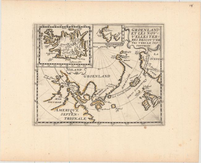
Subject: Greenland, Iceland

Period: 1648 (circa)

Publication: Theatre Geographique de l'Europe

Color: Hand Color

Size:
7.5 x 5.9 inches
19.1 x 15 cm
Download High Resolution Image
(or just click on image to launch the Zoom viewer)

This small and very rare map was based on the information from Jens Munk's expedition of 1619-20. Munk was sent by Denmark's King Christian IV to seek a Northwest Passage to the Orient. He left from Copenhagen in May of 1619 with two ships. They entered Hudson Bay in late August and wintered near present-day Churchill, (noted on the map as Port d'hyver de Munk). There they spent a terrible, scurvy ridden winter, during which nearly all of the 63 crew members died. Only two crewmen and Munk survived to return to Denmark. The map shows Hudson Bay, named Mer Christiane after the Danish king, and the mythical island of Frisland. Two inset maps depict Iceland and Spitzbergen. This edition has no text on verso and page number 14 at upper right.

References: Pastoureau BRIET II #14.

Condition: A

There are a few tiny spots and minor printer's ink residue.

Estimate: $550 - $700

Sold for: $300

Closed on 6/22/2016

Archived