Catalog Archive
Auction 158, Lot 196

"Peru & Bolivia", Arrowsmith, John
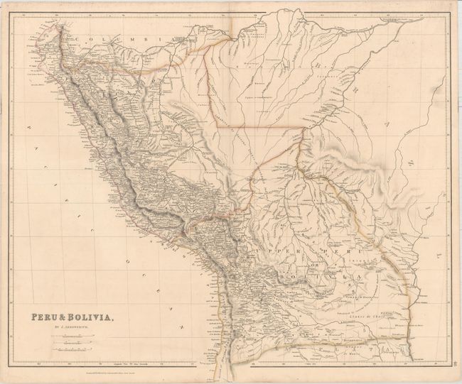
Subject: Western South America

Period: 1834 (dated)

Publication: The London Atlas of Universal Geography...

Color: Hand Color

Size:
23.6 x 20 inches
59.9 x 50.8 cm
Download High Resolution Image
(or just click on image to launch the Zoom viewer)

This detailed map spans the coast of western South America from the Tumbes Region to the southern part of the Atacama Desert in northern Chile. It extends inland as far as western Brazil, which is largely bereft of detail. Towns and cities, rivers, lakes, tribes, and more are identified. A couple of notes warn of regions "Inhabited by Various tribes of unsubdued Indians."

References:

Condition: B+

Original outline color with a short centerfold separation at bottom, minor offsetting, and light soiling that is largely confined to the blank margins.

Estimate: $160 - $190

Sold for: $120

Closed on 6/22/2016

Archived