Catalog Archive
Auction 157, Lot 653

Map of China Based on Father Martino Martini's Travels

"Imperii Sinarum Nova Descriptio", Loon, Jan van

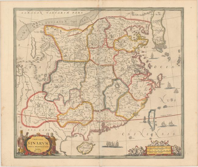
Subject: China & Korea

Period: 1657 (circa)

Publication:

Color: Hand Color

Size:
20.6 x 18.4 inches
52.3 x 46.7 cm
Download High Resolution Image
(or just click on image to launch the Zoom viewer)

This superb map of the Chinese Empire is drawn largely from the Blaeu map compiled by Jesuit Father Martino Martini who traveled through the region between 1643 and 1650. It deviates from that model in its depiction of the Korean peninsula, which is shown with a cluster of islands at its southern tip. The map is embellished with sailing ships and Chinese junks. The title cartouche is flanked by Chinese and Jesuit men and the scale of miles cartouche is surrounded by putti. Engraved by Johannes van Loon and first issued by Jan Jansson in his Atlas Novus in 1657. Blank verso.

References: Van der Krogt (Vol. I) #8410:1C.

Condition: B+

A clean and bright example on watermarked paper with minor toning along the centerfold and two small abrasions also along the centerfold. The impression is slightly weak in a few spots.

Estimate: $1,600 - $1,900

Unsold

Closed on 5/4/2016

Archived