Catalog Archive
Auction 157, Lot 379

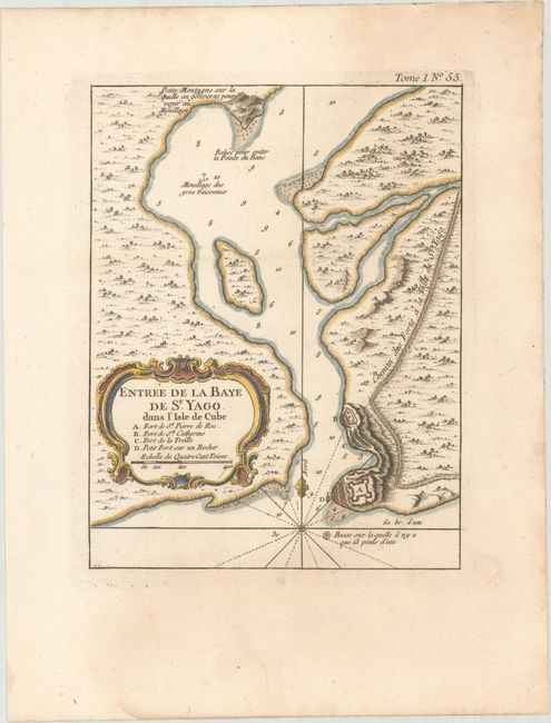
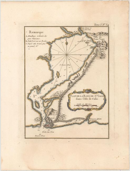
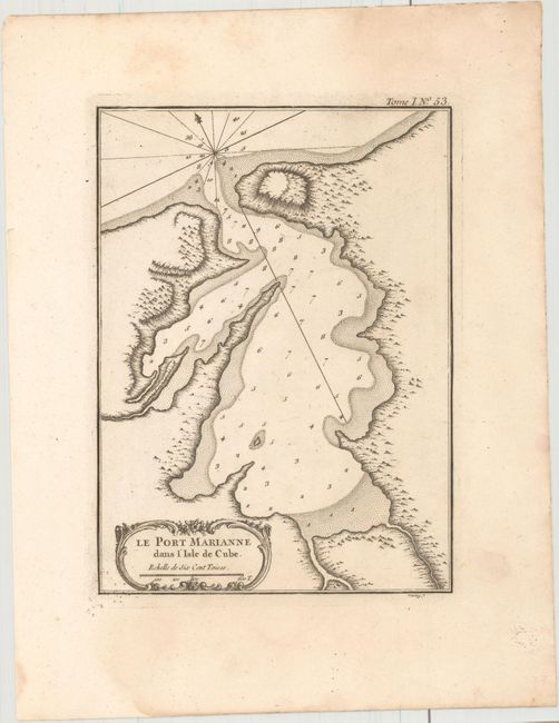
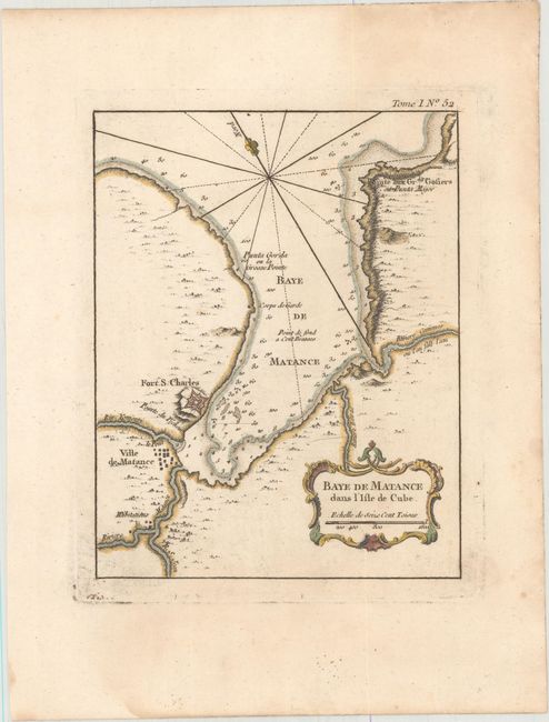
"[Lot of 4] Entree de la Baye de St. Yago dans l'Isle de Cube [and] Plan de la Baye de St. Yago dans l'Isle de Cube [and] Le Port Marianne dans l'Isle de Cube [and] Baye de Matance dans l'Isle de Cube", Bellin, Jacques Nicolas

Subject: Cuba

Period: 1764 (published)

Publication: Petit Atlas Maritime

Color:

Size:
6.6 x 8.6 inches
16.8 x 21.8 cm
Download High Resolution Image
(or just click on image to launch the Zoom viewer)

This nice matched set of maps of Cuba is from Bellin's work. Each chart includes depth soundings and is embellished with rhumblines, fleur-de-lys, and rococo-style title cartouches.

A. Entree de la Baye de St. Yago dans l'Isle de Cube, hand color. Detailing the southern portion of the bay of Santiago de Cuba, this chart locates various fortifications.

B. Plan de la Baye de St. Yago dans l'Isle de Cube, hand color. This engraved chart of Santiago de Cuba shows the entire bay with today's Santiago de Cuba here called Ville de Sant Yago. Fort St. Pierre de Roc and its batteries are clearly shown at the harbor's entrance.

C. Le Port Marianne dans l'Isle de Cube, black & white. This strongly engraved chart details the harbor of Marianne on the northwest coast of Cuba, near today's Havana.

D. Baye de Matance dans l'Isle de Cube, hand color. This shows La Cabana (Fort S. Charles), the 18th century fortress complex, on the Bay of Matanzas (Bay de Matance). Also shown is the Ville de Matance, today the capital of the province by the same name. The bay is about 30 miles east of Havana on the northernmost arc of the island.

References: Cueto #235, #261, #306, & #307; Sellers & Van Ee #1804, #1828, #1842, & #1843.

Condition: A

Each is a nice impression, and all but the second sheet is on watermarked paper. All have minor damp stains that are mostly confined to the blank margins and faint spots.

Estimate: $190 - $220

Sold for: $140

Closed on 5/4/2016

Archived