Catalog Archive
Auction 157, Lot 124

"Nouvelle Carte de la Province de Quebec Selon l'Edit du Roi d'Angleterre...", Le Rouge, George Louis

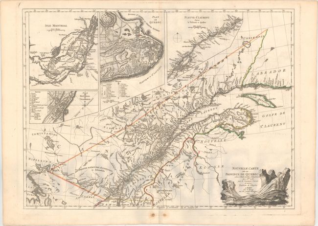
Subject: Quebec, Eastern Canada

Period: 1777 (dated)

Publication: Atlas Ameriquain

Color: Hand Color

Size:
25.9 x 19 inches
65.8 x 48.3 cm
Download High Resolution Image
(or just click on image to launch the Zoom viewer)

This is the first French edition of Captain Jonathan Carver's landmark map of the region around Quebec and the St. Lawrence River. It stretches from the eastern bank of Lake Huron into the Gulf of St. Lawrence, covering the region Carver explored during the French and Indian War. The primary purpose of the map was to depict the newly established boundaries of Quebec, as outlined in the Royal Proclamation of 1763. Numerous places are named, and there is excellent detail of the rivers and lakes of the area. There are four detailed insets: Isle Montreal, Plan de Quebec, Fleuve St. Laurent Depuis la Valterie a Quebec, and Plan de Montreal ou Villemarie. Keys within the plans of Quebec and Montreal identifies places of interest. The decorative title cartouche shows a swooping valley.

References: cf. Goss (NA) #61; Kershaw #1010; Shirley (BL Atlases) T.LER-3a #9.

Condition: B+

A crisp impression with original outline color on watermarked paper. There is minor offsetting, a couple pairs of worm tracks around the centerfold at bottom, and marginal soiling.

Estimate: $1,100 - $1,400

Sold for: $650

Closed on 5/4/2016

Archived