Catalog Archive
Auction 157, Lot 118

"[Lot of 3] British Columbia (New Caledonia) [on sheet with] Vancouver Island [and] Upper Canada [and] Lower Canada, New Brunswick, Nova Scotia &c.", Weller, Edward
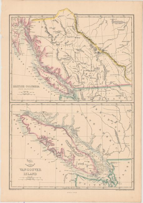
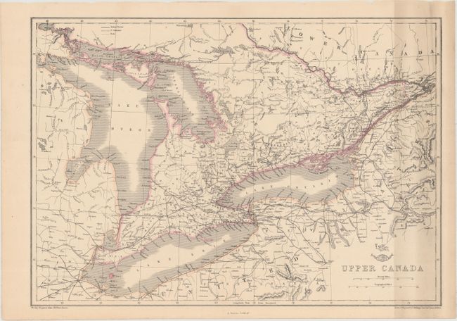
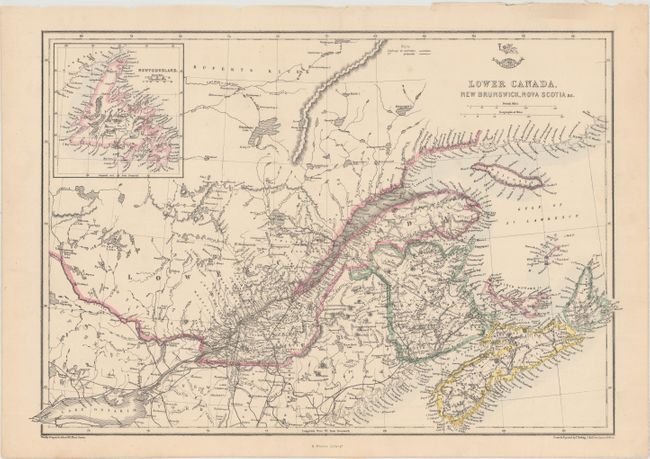
Subject: Canada

Period: 1860 (circa)

Publication: Weekly Dispatch Atlas

Color: Hand Color

Size:
11.9 x 17.1 inches
30.2 x 43.4 cm
Download High Resolution Image
(or just click on image to launch the Zoom viewer)

This set of three maps covers far western and eastern Canada. The western sheet features two handsome maps on one sheet. At top is a map of British Columbia with excellent detail of the region's network of rivers and lakes. Numerous islands off the coast are named. The bottom map focuses on Vancouver Island, identifying several bays, harbors, inlets, and more that do not appear on the map above it. The two eastern sheets include good detail of roads, railroads and counties. Drawn, engraved, and lithographed by Weller.

References:

Condition: B+

Original hand color with an extraneous horizontal crease on each sheet. The map of Upper Canada is moderately soiled at right.

Estimate: $120 - $150

Sold for: $90

Closed on 5/4/2016

Archived