Catalog Archive
Auction 156, Lot 99

Highly Unusual "Slate" Wall Map

"Williams' Slated Outline Map North America",

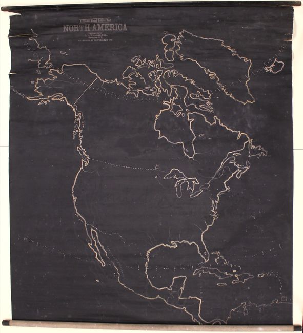
Subject: North America

Period: 1899 (dated)

Publication:

Color: Black & White

Size:
43.4 x 47.9 inches
110.2 x 121.7 cm
Download High Resolution Image
(or just click on image to launch the Zoom viewer)

This scarce wall map was intended as a teaching aid for use in schools. It covers all of North America, spanning from Greenland south to the West Indies and northern South America, and from the Bering Strait east to Iceland. The map is nearly blank with only a few unidentified political boundaries, rivers, lakes, etc. As the title indicates, the map is covered in a thin coating of slate so that boundaries and features could be drawn (and erased) with chalk for instructional purposes. Original rollers are present and attached. Published by Frederick Dumont Williams of Horseheads, New York. Williams apparently also issued slated maps of the United States, Asia, Africa and Europe according to the Library of Congress catalog of copyright entries (1902). No institutional holdings or price records in the last 35 years.

References:

Condition: B

Overall good condition for a working example with some cracking and several edge tears near the top roller with a 4.5" tear at top left just touching the map image. There is a 0.75" x 0.25" hole just to the left of Greenland, minor surface abrasions and light staining.

Estimate: $300 - $500

Sold for: $180

Closed on 2/17/2016

Archived