Catalog Archive
Auction 156, Lot 810

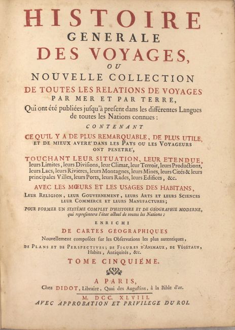
"Histoire Generale des Voyages, ou Nouvelle Collection de Toutes les Relations de Voyages par Mer et par Terre ... Tome Cinquieme", Prevost, Anton Francois

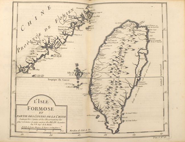
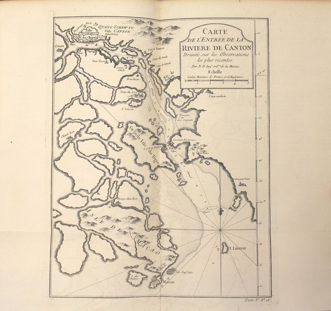
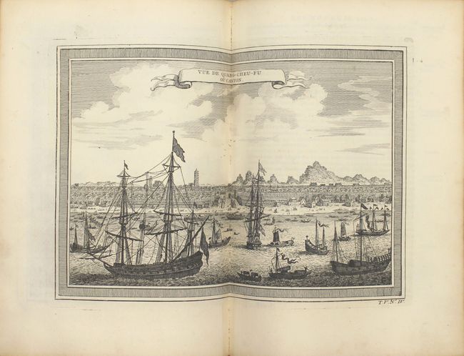
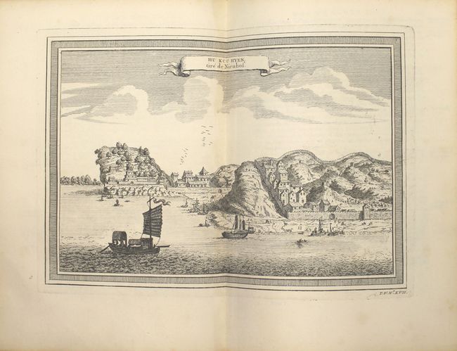
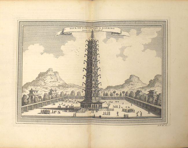
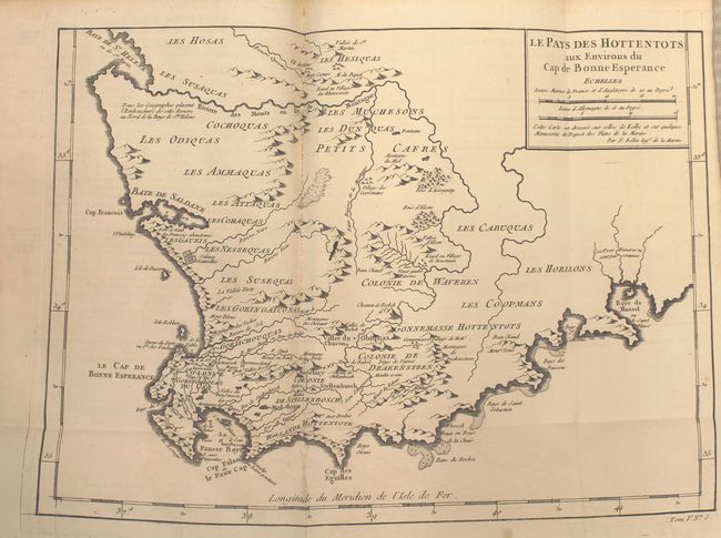
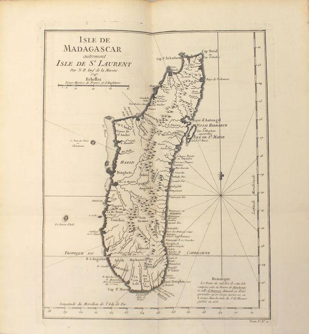
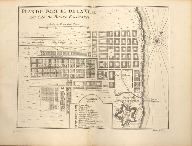
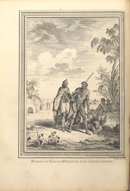
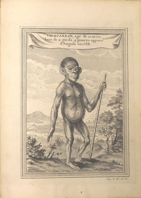
Subject: Exploration and Surveys, Africa, China

Period: 1748 (published)

Publication:

Color: Black & White

Size:
8 x 10.3 inches
20.3 x 26.2 cm
Download High Resolution Image
(or just click on image to launch the Zoom viewer)

This is a very nice example of volume five of Prevost's history of voyages, with maps by Jacques Nicolas Bellin. The volume is divided into two parts and describes southern and eastern Africa along with an extensive section on China, including many single and double-page plates depicting the region. The maps included in this volume are:

A. Carrte de la Coste d'Angola (10.0 x 8.2").
B. Carte de la Rade de Benguella et Riviere de Cantonbelle (10.3 x 8.2").
C. Le Pays des Hottentots aux Environs du Cap de Bonne Esperance (13.0 x 9.7"). A beautifully engraved copper-plate map of the Cape of Good Hope from Saint Helena Bay to Mossel Bay. Dutch settlements are mostly confined along the coast and southern regions. The inland regions are depicted as deserts, savannas, forests and mountain ranges with tribal names indicated and a few Boer colonies.
D. Carte de la Baye de Saldana ou Saldane (10.3 x 8.2").
E. Carte de la Baye de la Table et Rade du Cap de Bonne Esperance (6.5 x 8.7").
F. Plan du Fort et de la Ville du Cap de Bonne Esperance (10.2 x 8.2"). Detailed plan of the Dutch fort and settlement at the Cape of Good Hope showing the town and fort with a key at bottom listing fourteen important locations.
G. Carte de la Baye de Sainte Helene (6.5 x 8.3").
H. Carte de la Baye de Mosambique (6.2 x 8.3").
I. Carte de l'Isle de Monbasa (6.5 x 8.2").
J. Plan de l'Isle et Ville de Quiloa (5.8 x 8.7").
K. Isle de Madagascar autrement Isle de St. Laurent (8.7 x 11.4"). Fine map of Madagascar with good detail of the mountainous topography, rivers, sand bars, and harbors. The note at bottom right explains that the southeastern portion of the island, between the Antavare and Mandreray Rivers, requires a level of detail that could not be included on this map, but is available on a map by Sr. de Flecourt published in 1656.
L. Carte des Isles de Comore Johanna ou Anjouan Mohilla ou Moaly et Mayote (9.3 x 8.4").
M. Carte de l'Isle d'Anjouan (6.4 x 8.3").
N. Empire du Monomotapa et Etats Voisins...(10.3 x 8.1").
O. La Chine avec la Coree...(12.4 x 10.9").
P. Carte de l'Entree de la Riviere de Canton... (8.0 x 10.0"). This copper engraved map centers on the mouth of the Canton River with the island of Macao and the future site of Hong Kong, here called Sinn-gan-hien. The fortified city of Canton is divided into Tartar and Chinese districts. Soundings and anchorages are shown and the map is decorated with a cartouche, rhumb lines, and fleur-de-lis.
Q. Plan de la Ville et du Port de Macao (6.5 x 8.2").
R. Plan de la Ville de Peking (6.5 x 8.3").
S. L'Isle Formose et Partie des Costes de la Chine (11.2 x 9.2"). This charming map of Taiwan is one of the few maps to focus on the island. It includes the coast of Fokien and the Taiwan Strait with nice topographical and place name information.
T. Plan de l'Enceinte de la Ville de Nan-King [on sheet with] Plan de la Ville de Su-Tcheou-Fou (10.8 x 8.2").
U. Carte de la Baye de Chin-Chew ou Chang-Chew...(11.8 x 8.3").
V. Vusihyen [on sheet with] Hou-Tcheou-Fou (5.7 x 8.7").
W. Plans de Quelques Villes de la Province de Hou-Quang (11.8 x 7.8").

564 pp. of text with 24 maps and 40 plates of illustrations. Hardbound in full marbled calf with gilt title label and raised bands on spine.

References:

Condition: A

Attractive example that is internally very clean and bright. The maps all have dark impressions with only a handful showing faint offsetting. Externally, there are a few chips along the joint and spine at bottom with surface abrasions to the covers.

Estimate: $950 - $1,100

Sold for: $700

Closed on 2/17/2016

Archived