Catalog Archive
Auction 156, Lot 799

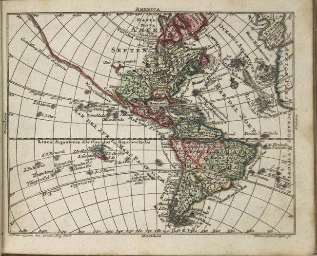
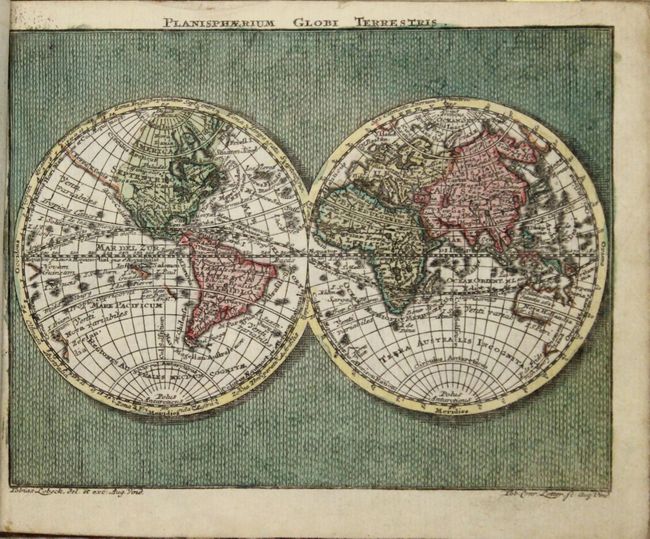
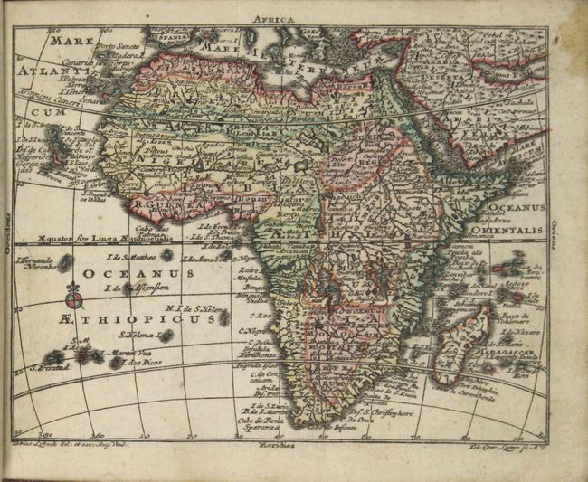
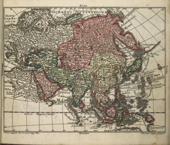
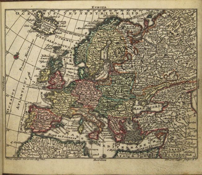
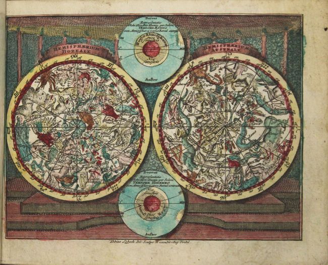
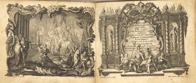
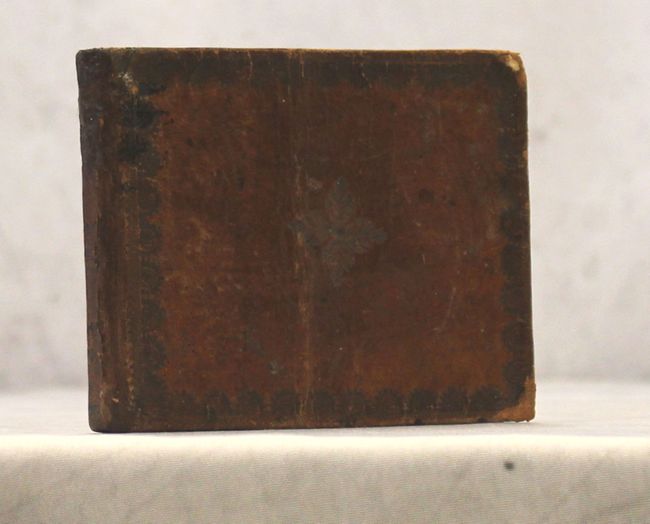
Uncommon Miniature Atlas

"Atlas Geographicus Portatilis XXIX. Mappis Orbis Habitabilis Regna Exhibens...", Lotter/Lobeck

Subject: Atlases

Period: 1760 (circa)

Publication:

Color: Hand Color

Size:
5.9 x 4.6 inches
15 x 11.7 cm
Download High Resolution Image
(or just click on image to launch the Zoom viewer)

Fine pocket atlas with decorative maps in full original color. It opens with an allegorical frontispiece, followed by a title page in an architectural cartouche, both drawn by Gottfried Eichler, junior. The maps include the celestial and terrestrial hemispheres, the continents, and detailed maps of western and eastern Europe. Most maps are embellished with a fine title cartouche. The maps are followed by a list of maps and a Geographie (72 pages) printed for Lobeck by Johann Michael Spaeth. This atlas was a collaborative publication between Tobias Conrad Lotter and Tobias Lobeck, first published in 1747 with an almanac. The atlas remained in use for many years, with the maps reprinted and with new maps added, but the title page continued to report 29 maps. The maps present are:

1) Planisphaerium Globi Terrestris
2) Hemisphaerium Boreali [and] Hemisphaeriusm Australe
3) Europa
4) Asia
5) Africa
6) America
7) Regnorum Hispaniae et Portugalliae Tabula generalis
8) Totius Regn. Galliae sive Franciae Tabula
9) Nova Totius Italiae cum adjacentibus Maroribus et Minoribus Insulis
10) Republic di Genova
11) Status Ecclesiastici Magni que Ducatus Florentini Tabula
12) Magna Britannia complectens Angliae, Scotiae, et Hiberniae Regna
13) Tabula Gener. Totius Belgii qua Provinciae XVII Infer. Germaniae olim sub S.R.I. Circula Burgundiae
14) Germania Inferior
15) Potentissimae Helvetiorum Reipublicae Cantones Tredecim
16) Circuli Germaniae
17) Cercle d'Autriche
18) Cercles de Baviere, de Suabe, de Franconie…
19) Vereinigte Niederlande, Spanische Niederlande, Herzogt. Brabant, Herzogt. Luxemburg, Graefsch. Flandern
20) Cercle de Saxonie…
21) Boheme, Morovia, & Saxonie, Lusace, Silesie…
22) Circuli Westphaliae in Omnes Status et Provincias
23) Circuli Franconiae
24) Tabula Marchionatus Brandeburgici et Ducatus Pomerania
25) Ducatus Pomeraniae
26) Marchionatus Brandenburgici Pars
27) Ducatus Silesiae Inferioris Tabula
28) Ducatus Silesiae Superioris
29) Circuli Supe Saxoniae Pars Meridionalis…
30) Pars Meridionalis Circuli Saxoniae Superioris
31) Tabula Circubus Saxoniae Inferioris…
32) Circulus Westphalicus I. Pars
33) Circuli Saxoniae Inferioris In Omnes Suos Status et Principatus II Pars
34) Circuli Thuringiae I. Pars
35) Bohemiae Regnum in Circulos suos divisii
36) Poloniae Regnum, Ducatusq Magnae Lithuaniae
37) Borussiae Regnum cum Adjacentibus Regionibus
38) Regnum Daniae
39) Regnum Sueciae
40) Impericum Russiqum Omnisque Tartaria
41) Regni Hungariae Tabula Generalis
42) Tabula Dunabii Graeciae et Archipelagi.

Following the maps is the list of maps, "Index mapparum Geograhicarum," which lists only 29 maps. The atlas' collation does not, as often found, exactly match the list given on the Index. A second title page "Kurzgesasste Geographie, in sich haltend einen aneinander hangenden Entwurf…Sack-Atlas…Tobias Lobeck…" follows with 70 pages of text, lacking pages 71-72. Oblong 32mo in original embossed calf binding. A lovely example of this uncommon atlas.

References: King (2nd Ed.) p. 171; cf. Mickwitz & Miekkavaara #134.

Condition: A

The maps are clean and bright in full original color with occasional minor soiling at bottom right where the pages were turned. Map #26 has a small chip in bottom blank margin. Covers are cracked and slightly bent and corners are rubbed. Covers and spine have been professionally reattached to text block with repairs to several chips in spine.

Estimate: $1,600 - $1,900

Sold for: $1,000

Closed on 2/17/2016

Archived