Catalog Archive
Auction 156, Lot 798
Charming Mid-Eighteenth Century French Atlas
"Atlas Nouveau Portatif a l'Usage des Militaires. Et du Voyageur Contenant 91 Cartes Dressees sur les Nouvelles Observations...", Le Rouge, George Louis

Subject: Atlases
Period: 1748 (published)
Publication:
Color: Hand Color
Size:
7.2 x 9 inches
18.3 x 22.9 cm
Download High Resolution Image
(or just click on image to launch the Zoom viewer)
(or just click on image to launch the Zoom viewer)
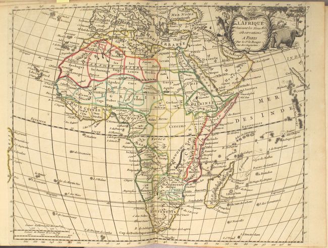
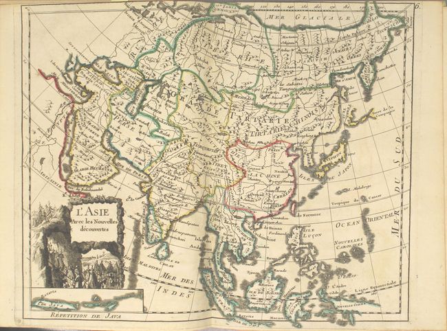
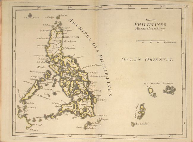
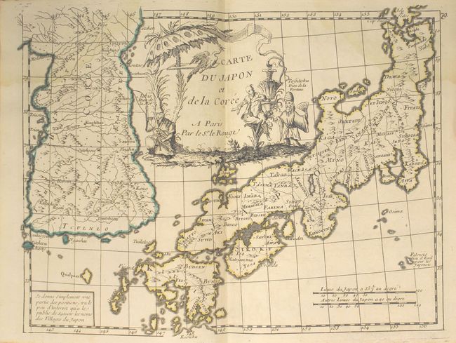
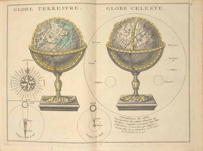
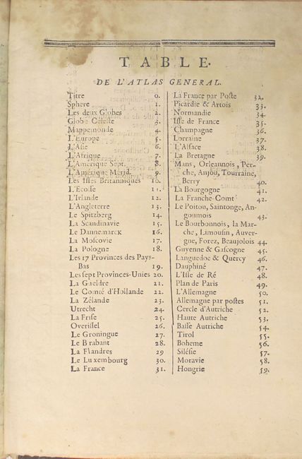
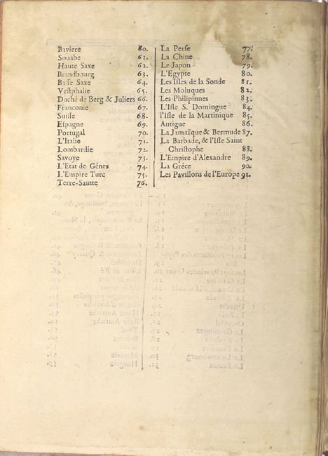
This charming "portable" atlas includes 88 (of 91) plates and a 36-page introduction to geography. The plates consist of 87 maps and charts and a plate of maritime flags around the world. There are charts of the solar system, celestial hemispheres, and terrestrial and celestial globes. The maps include the world, the five continents, 63 relating to Europe, 9 relating to Asia, Egypt, and 5 relating to the Caribbean. See images for the list of maps. The missing maps are Southern Austria, Tirol, and Bohemia (#54, 55, and 56).
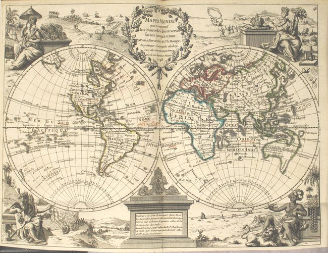
The world map, Mappe Monde qui Comprend les Nouvelles Decouvertes Faites Jusqu'a ce Jour, is a double hemisphere map with the female representations of the continents adorning each corner. The Northwest part of North America is nearly blank except for a complex river and lake system alluding to a Northwest Passage. The only place names in North America are Californie, F. Francois, Louisiane, N. Orleans, Virginie, and Quebec. Nouvelle Hollande is shown with the known coastlines connected between the mainland, Tasmania and New Guinea, creating an oddly shaped landmass. Terre d'Yesso (Hokkaido) is only partially delineated, and an island labeled appears just to the east.
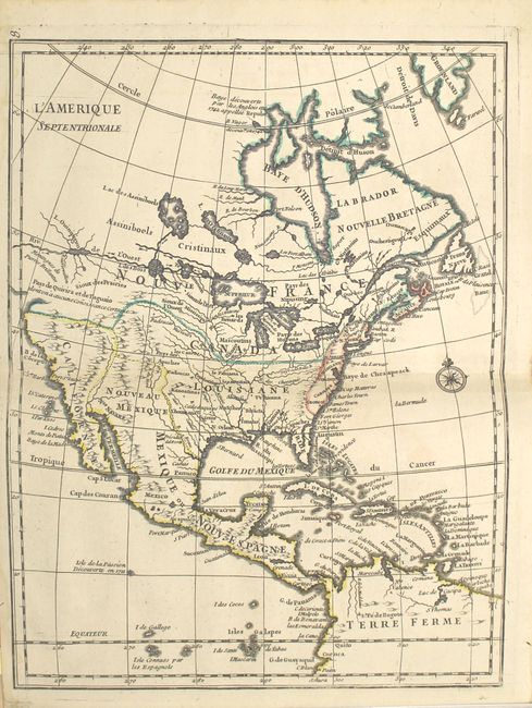
The map of North America, L'Amerique Septentrionale, displays some very interesting theoretical cartography concerning a Northwest Passage. The most prominent feature is a River of the West, which connects Lake Superior with the Lake of the Woods and Lake Winnipeg and then flows off the map supposedly to the Pacific. It also links through a system of streams and lakes to Hudson Bay.
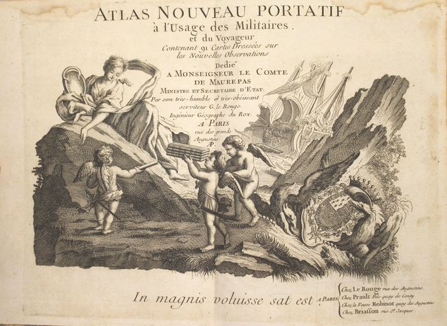
The lovely title page features putti presenting a stack of books to a female figure (possibly Aphrodite holding a mirror). In the background, a ship is filled with women and children, with one of the females apparently using a depth measuring device. The atlas is dedicated to Jean-Frederic Phelypeaux, Count of Maurepas, and features the family coat of arms at bottom right.
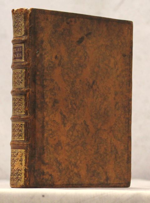
Octavo in full original mottled calf, raised bands, red leather title label and gilt tooling on spine.
The map of North America, L'Amerique Septentrionale, displays some very interesting theoretical cartography concerning a Northwest Passage. The most prominent feature is a River of the West, which connects Lake Superior with the Lake of the Woods and Lake Winnipeg and then flows off the map supposedly to the Pacific. It also links through a system of streams and lakes to Hudson Bay.
The lovely title page features putti presenting a stack of books to a female figure (possibly Aphrodite holding a mirror). In the background, a ship is filled with women and children, with one of the females apparently using a depth measuring device. The atlas is dedicated to Jean-Frederic Phelypeaux, Count of Maurepas, and features the family coat of arms at bottom right.
Octavo in full original mottled calf, raised bands, red leather title label and gilt tooling on spine.