Catalog Archive
Auction 156, Lot 775

NO RESERVE

"Carte des Decouvertes Faites dans la Mer Pacifique sur le Vaisseau de Roi, la Resolution, Commande par le Capitaine Cook, en 1774", Cook/Benard

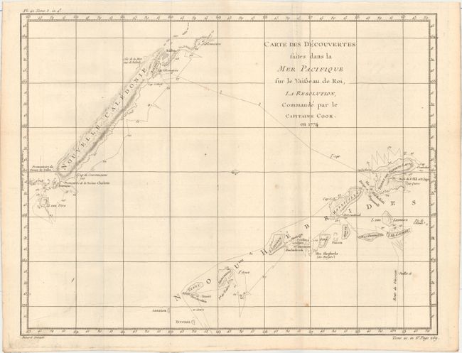
Subject: South Pacific Ocean

Period: 1778 (circa)

Publication: Abrege de l'Histoire Generale des Voyages

Color: Black & White

Size:
18.1 x 14.1 inches
46 x 35.8 cm
Download High Resolution Image
(or just click on image to launch the Zoom viewer)

Captain James Cook (1728-1779) is best known for his three voyages to the Pacific (1768-71; 1772-75; and 1776-79). His discoveries radically changed the western understanding of the world in the late 18th century. He was the first to circumnavigate and chart New Zealand and provided the earliest European accounts of exploration along the eastern coast of Australia and the Hawaiian Islands. On February 14th, 1779, he was killed on Hawaii after attempting to kidnap the chief of the island.

Many contemporary accounts of Cook’s voyages, including charts and engravings, appeared in the late 18th century. The first official account of Cook’s first voyage was published in 1773 by John Hawkesworth in Volumes II and III of An Account of the Voyages Undertaken by the Order of His Present Majesty for Making Discoveries in the Southern Hemisphere... William Strahan and Thomas Cadell published the first official accounts of the second and third voyages in 1777 and 1784. Accounts of his exploration were subsequently translated into French, German, and Dutch.

Delicately engraved exploration chart details the second voyage (1774) of Captain Cook in the Pacific. The track of the HMS Resolution near New Caledonia and New Hebrides, situated well off the east coast of Australia, is shown with a daily timeline. Hazards noted along the ship's track include shoals and rocks.

References:

Condition: B+

A nice impression, issued folding, with a couple of small spots and very light toning along one fold.

Estimate: $100 - $130

Unsold

Closed on 2/17/2016

Archived