Catalog Archive
Auction 156, Lot 590

"Nouveau Plan de la Ville de Rome Tire par Ordre du Pape par Matteo Gregoria de Romans Tres Utille pour les Voiageurs", Chatelain, Henry Abraham

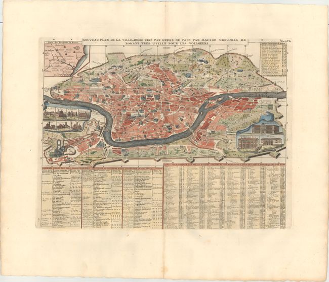
Subject: Rome, Italy

Period: 1719 (circa)

Publication: Atlas Historique

Color: Hand Color

Size:
16.9 x 13 inches
42.9 x 33 cm
Download High Resolution Image
(or just click on image to launch the Zoom viewer)

This amazing map of Rome illustrates numerous important buildings located within the fortified city. The extensive table along the lower half keys specific "tourist" sights, residences, important buildings, etc. Two insets handsomely presented as unfurled scrolls show the elevation of the most important buildings including Palais du Pape, Palais de St. Pierre, Ste. Marie and several other churches. Plus a third inset is a map "Carte des Environs de Rome" and at upper right a table lists the churches of Rome. This handsome city plan is displayed in a partial bird's-eye view perspective giving it a somewhat three-dimensional feel.

References:

Condition: A

A crisp impression with attractive color, wide margins, and light marginal soiling.

Estimate: $300 - $375

Sold for: $220

Closed on 2/17/2016

Archived