Catalog Archive
Auction 156, Lot 54

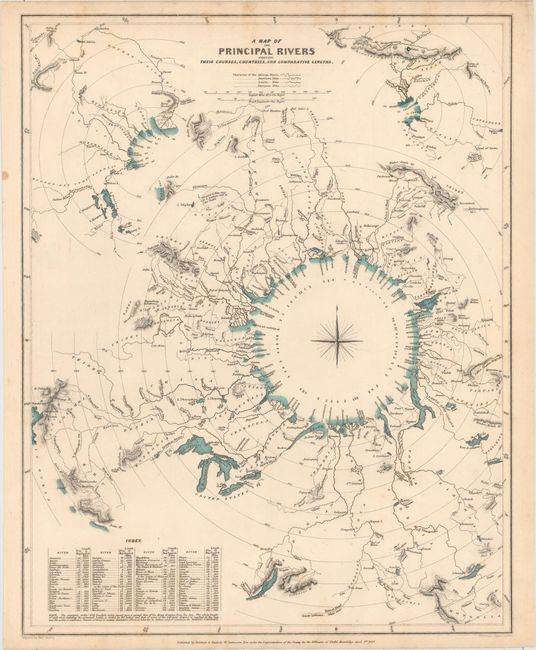
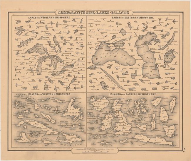
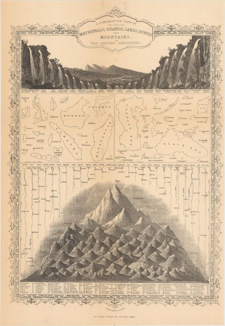
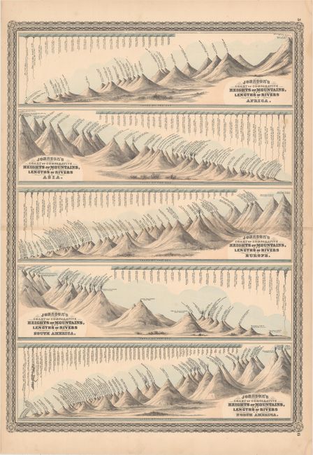
"[Lot of 4] A Map of the Principal Rivers... [and] Comparative Size of Lakes and Islands [and] A Comparative View of the Principal Waterfalls, Islands, Lakes, Rivers... [and] Johnson's Chart of Comparative Heights of Mountains, and Lengths of Rivers...",

Subject: Cartographic Miscellany

Period: 1834-64 (circa)

Publication:

Color:

Size:
See Description
Download High Resolution Image
(or just click on image to launch the Zoom viewer)

A. A Map of the Principal Rivers Shewing Their Courses, Countries, and Comparative Lengths, by SDUK Society for the Diffusion of Useful Knowledge, dated 1834, hand color (12.3 x 15.6"). A very attractive and interesting comparative thematic chart uniquely arranged on concentric circles around a classic compass rose. The rivers are depicted with their relative distance from the sea, including an index of each river’s length in English miles. Associated towns and lakes are noted and respective countries are identified in capital letters keyed with an index at lower left. Two smaller, partial concentric circles located in the upper corners show additional rivers in the same fashion. This is a fine thematic map that utilizes a unique method to graphically compare the rivers of the world. Engraved by Thomas Starling and published in London by Baldwin & Cradock. Condition: Minor soiling mostly in the blank margins.

B. Comparative Size of Lakes and Islands, by J.H. Colton & Co., dated 1858, black & white (14.7 x 12.1"). This thematic map shows the primary islands and lakes of the world. In four panels, they are divided between Western and Eastern hemispheres. Condition: Overall light toning and a few spots of foxing.

C. A Comparative View of the Principal Waterfalls, Islands, Lakes, Rivers and Mountains, in the Eastern Hemisphere, by John Tallis, circa 1855, black & white (9.9 x 13.9"). This is a later edition of this handsome engraving that graphically shows, through relative size, the length of rivers, height of mountains, and the size of lakes and waterfalls. Decorative borders. Condition: Issued folding with a hint of toning along the folds.

D. Johnson's Chart of Comparative Heights of Mountains, and Lengths of Rivers of Africa [on sheet with] ... Asia [and] ... Europe [and] ... South America [and] ... North America, by A.J. Johnson, dated 1864, hand color (16.8 x 23.1"). This graphically impressive sheet shows the relative size of mountains and rivers by continent. Each river/mountain is named along with its length/size. Surrounded by a decorative border. Condition: A few small spots and a fold separation that enters 5" into the image at right that has been closed on verso with archival tape.

References:

Condition: B+

See description above.

Estimate: $160 - $200

Sold for: $100

Closed on 2/17/2016

Archived