Catalog Archive
Auction 156, Lot 459

"Nieuwe Paskaart van de Noord Bodem. Beginnende aen de Oost Zyde van Abo tot Torne en aen de Westkant...", Keulen, Johannes van

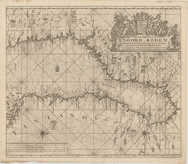
Subject: Gulf of Bothnia

Period: 1728 (circa)

Publication: [Gedrukr tot Amsterdam by Johannes van Keulen...]

Color: Black & White

Size:
23.1 x 19.9 inches
58.7 x 50.5 cm
Download High Resolution Image
(or just click on image to launch the Zoom viewer)

This intricately engraved chart focuses on the Gulf of Bothnia. The gulf is filled with rhumb lines, soundings, hazards, hundreds of tiny islands, and a single ship. A plethora of place names appear along Finland and Sweden's coasts along with some topographical detail. Seven coats-of-arms are illustrated as well. North is oriented to the right by compass roses topped with fleurs-de-lis. There are two cartouches, one for the distance scales at bottom left and a more elaborate one for the title at top right with various martial and allegorical figures around a sumptuous coat-of-arms.

References: Shirley (BL Atlases) M.KEU-3b #17.

Condition: A

A dark impression on a watermarked sheet (E. V. Oorspronk) with a faint damp stain at bottom left, light printer's ink residue, and a printer's crease at bottom.

Estimate: $475 - $600

Sold for: $350

Closed on 2/17/2016

Archived