Catalog Archive
Auction 156, Lot 454

"Canalis Inter Angliae et Galliae Littora / Pascaert van 't Canaal Tusschen Engeland en Vranckryck", Ottens, Reiner and Joshua

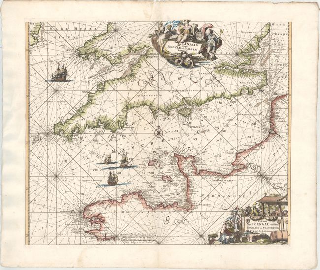
Subject: English Channel

Period: 1739 (circa)

Publication:

Color: Hand Color

Size:
22 x 18.6 inches
55.9 x 47.2 cm
Download High Resolution Image
(or just click on image to launch the Zoom viewer)

Magnificent chart of the channel and portions of England and France. Filled with rhumb lines and soundings, anchorage locations, hazards, etc. Embellished with a number of very fine sailing vessels, two large and elaborate cartouches, and a compass rose. The Latin title is in a cartouche decorated by a figure of Neptune and other mythological figures. The Dutch title is in a cartouche decorated with a merchant and his wares, and a winemaking scene. This map was originally made and published by Frederick de Wit. The plate was acquired by the Ottens brothers after the death of De Wit's son in 1706. Following the general custom of the time, the Ottens erased the De Wit imprint, replacing it with their own.

References:

Condition: A

A dark impression with attractive color and wide margins. There is marginal soiling and the paper is lightly cockled in the left blank margin.

Estimate: $700 - $850

Sold for: $500

Closed on 2/17/2016

Archived