Catalog Archive
Auction 156, Lot 414

"[Lot of 2] Carte Reduite des Mers du Nord, pour Servir a l'Histoire Generale des Voyages [and] Carte du Groenland",

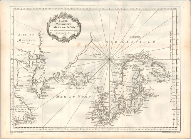
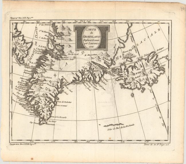
Subject: North Atlantic

Period: 1758-70 (dated)

Publication: Histoire Generale des Voyages

Color: Black & White

Size:
See Description
Download High Resolution Image
(or just click on image to launch the Zoom viewer)

A. Carte Reduite des Mers du Nord, pour Servir a l'Histoire Generale des Voyages, by Jacques Nicolas Bellin, dated 1758 (17.8 x 13.1"). This nice chart is centered roughly on Iceland and covers from the eastern shores of Canada through Greenland to Scandinavia and Britain. The coastlines are intricately drawn with coastal place names the only detail. A fine chart with decorative title cartouche and rhumb lines.

B. Carte du Groenland, by J. Laurent, dated 1770 (10 x 7.6"). This finely engraved chart of Greenland and Iceland shows the Davis Strait and a portion of Baffin Island in Northeast Canada. Many harbors are located on Greenland's coast with inlets and bays. Three channels are marked with dotted lines apparently demarking the three islands that were thought to make up the tip of Greenland. A small hint of the northern coast of the fictitious Frisland appears as well.

References:

Condition: B+

Dark impressions, issued folding on watermarked paper with light offsetting. There is a small stain adjacent to the title cartouche on the first map.

Estimate: $160 - $190

Sold for: $60

Closed on 2/17/2016

Archived